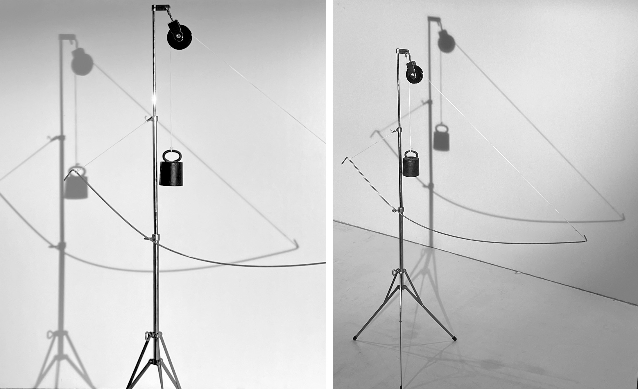
SPATIAL INDETERMINACY
To further understand the study site, the first analytical exercise involved a series of spatial model assemblages exploring the inherent tensions within industrial landscapes. Drawing inspiration from Diller & Scofidio’s concept of the hinge, these models emphasize the necessity of counterweights in spatial formations. This approach reconstructs the state of tension embedded in the Çanakkale region, with a specific focus on the mine as a catalyst for territorial and social complexities. Figure 7 captures this logic, defining the primary organizational forces in sites of plausible Indeterminacy.
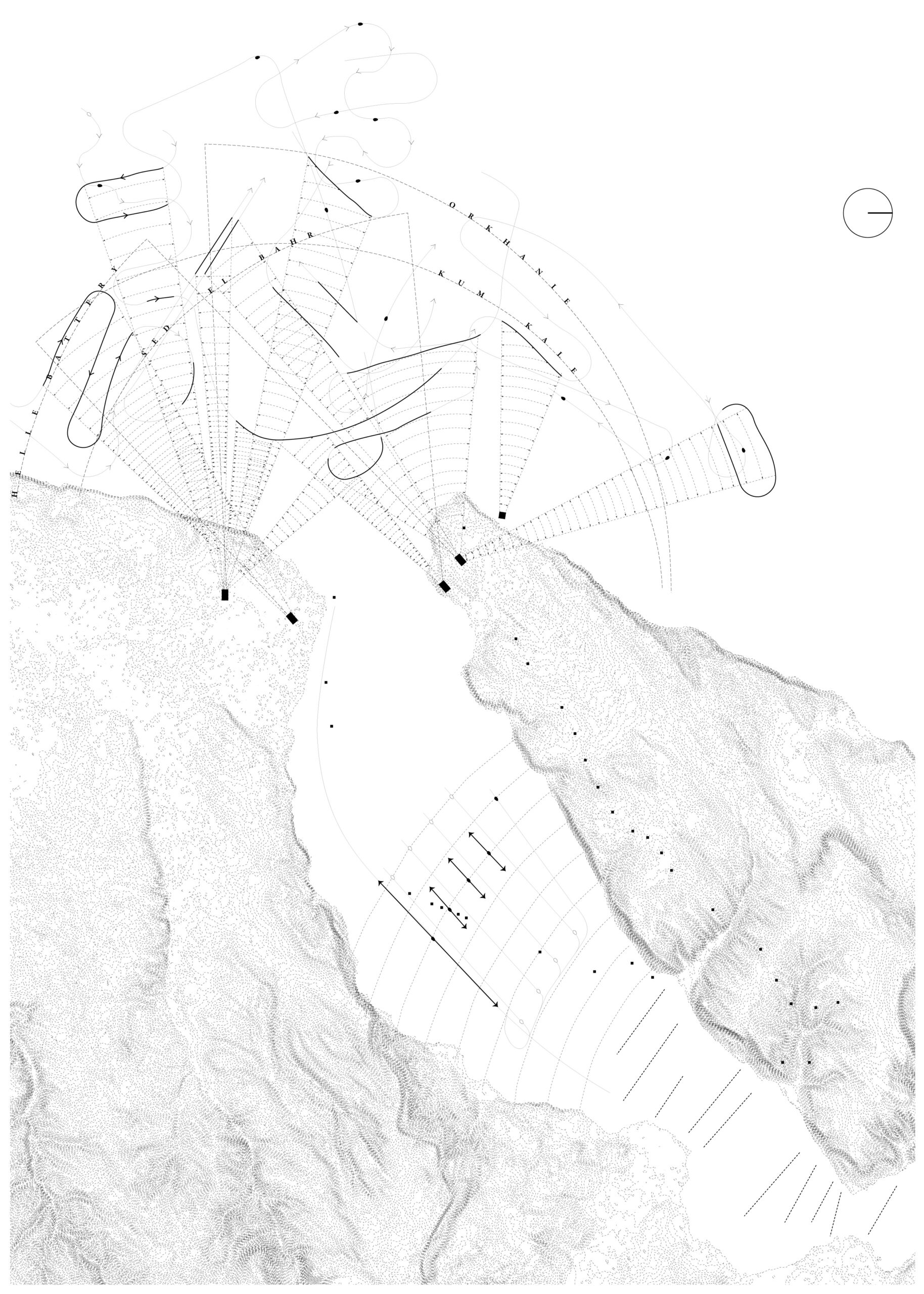
Building on this methodology, the study repositions Indeterminacy as a spatial phenomenon, drawing an unexpected parallel with the movement strategies of Allied forces during the 1915 Battle of Gallipoli. By mapping the patterns of naval movement, defense fortifications, firing trajectories and attack ranges, the study area transforms into a spatial choreography of conflict. This military strategy exploited spatial Indeterminacy as a tactical advantage, deploying forts, decoys and underwater minefields to create a condition of deliberate Indeterminacy.
This historical allegory offers a critical lens through which to examine the study site. The proximity of Gallipoli to the highway under investigation suggests a continuum of territorial transformations shaped by Indeterminacy — whether through war, industry or environmental disruption. These insights direct the research toward more specific regions of interest, where Indeterminacy becomes an operative spatial force.