TERRITORY OF DEATH
Jesse Verdoes
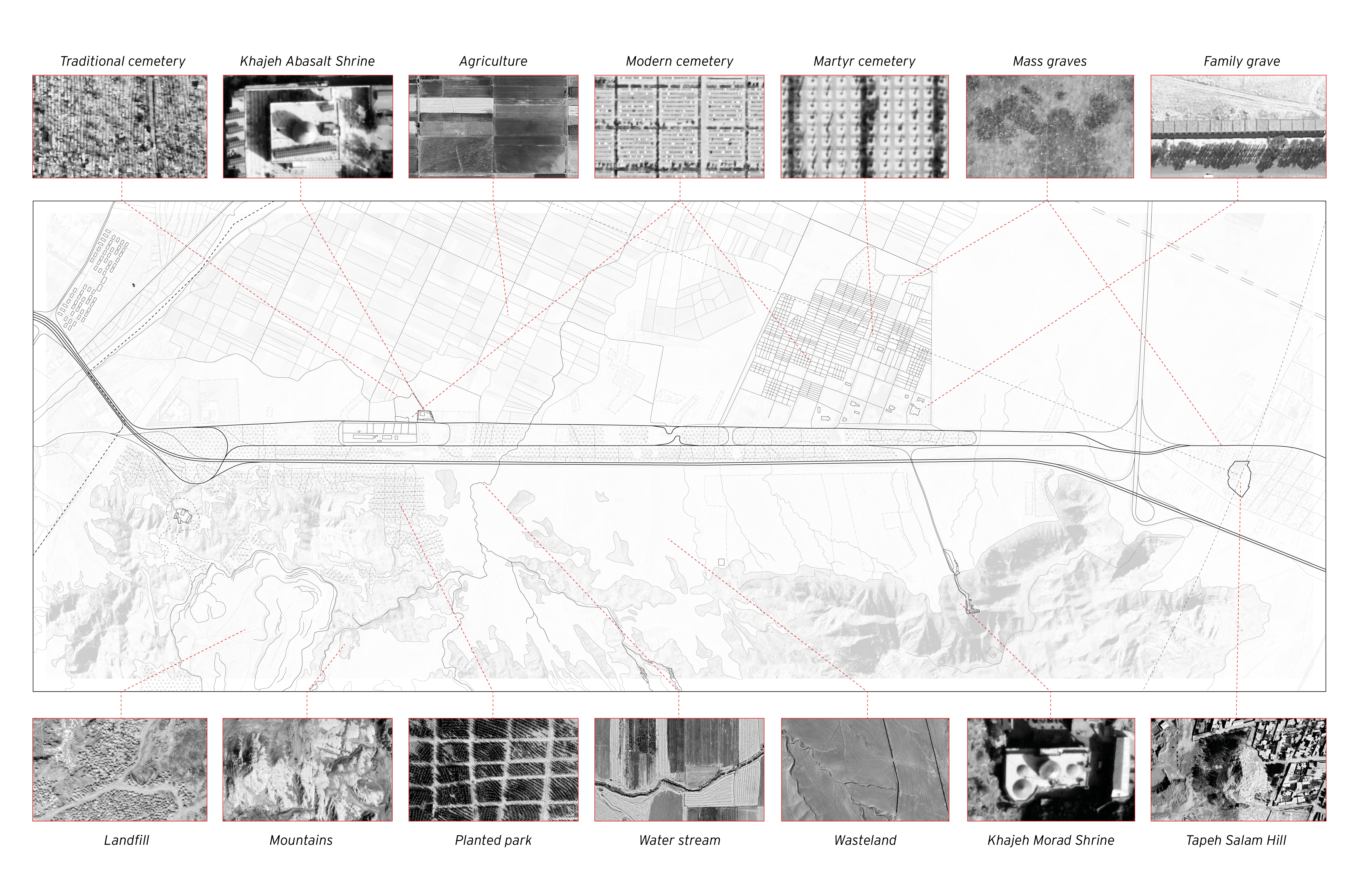
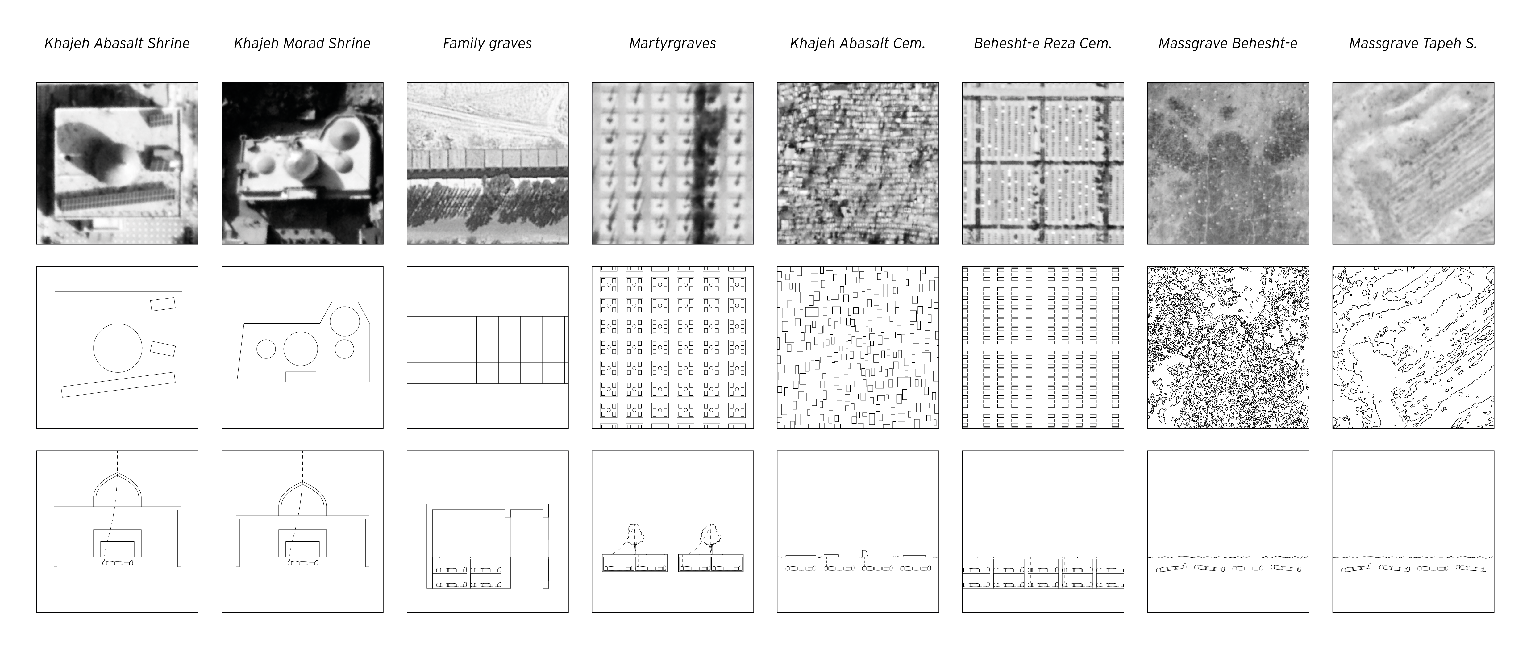
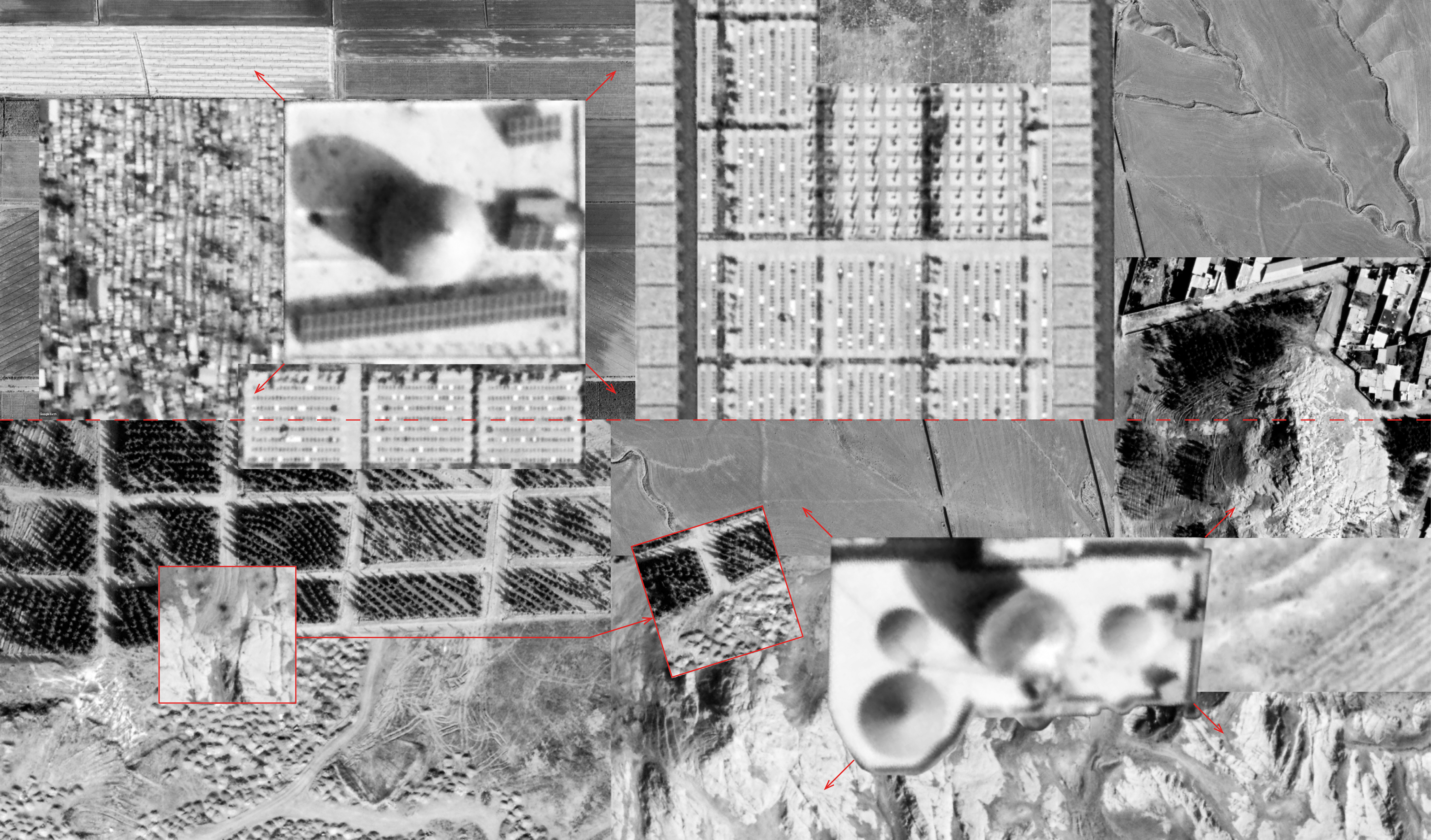
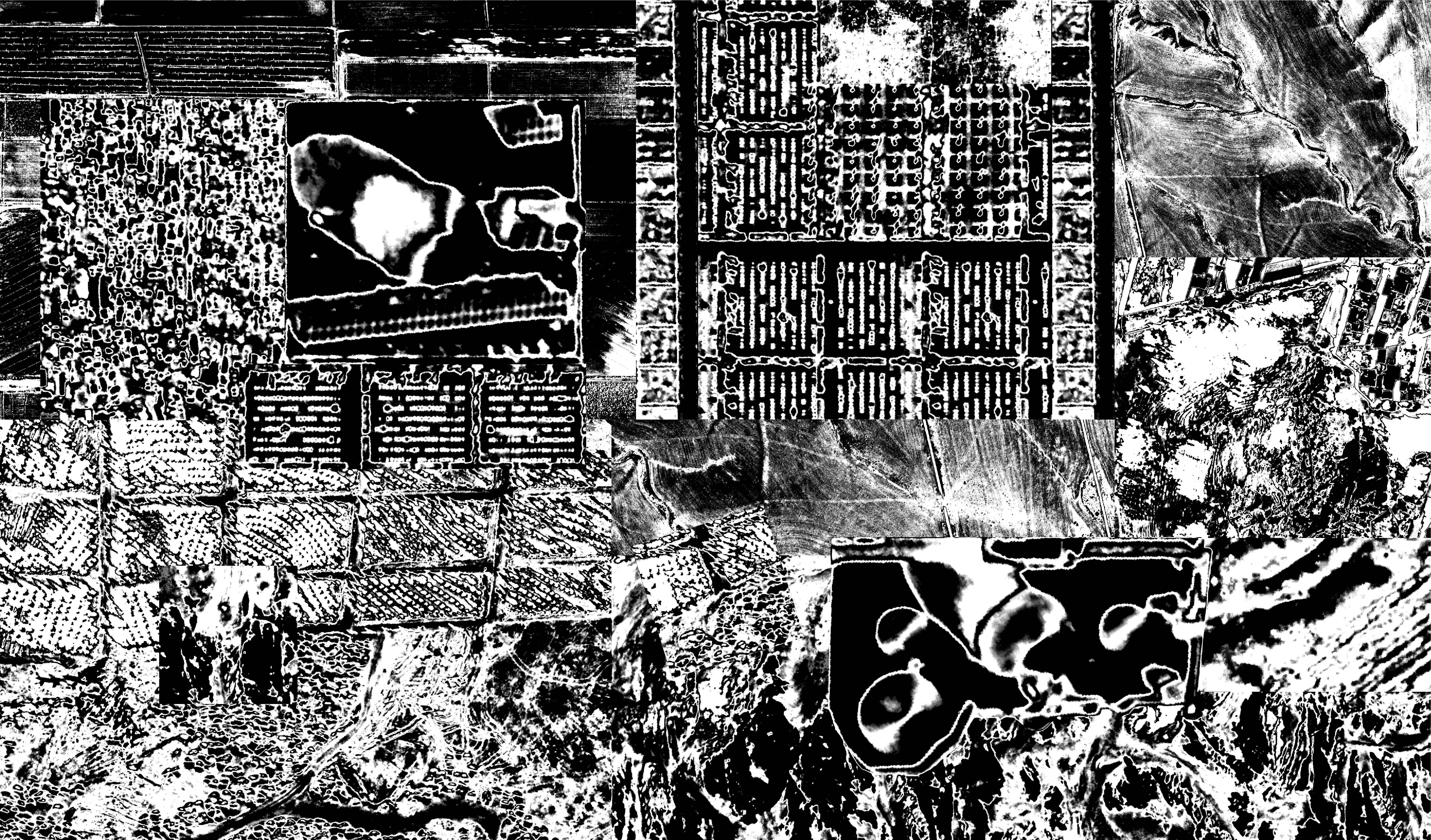
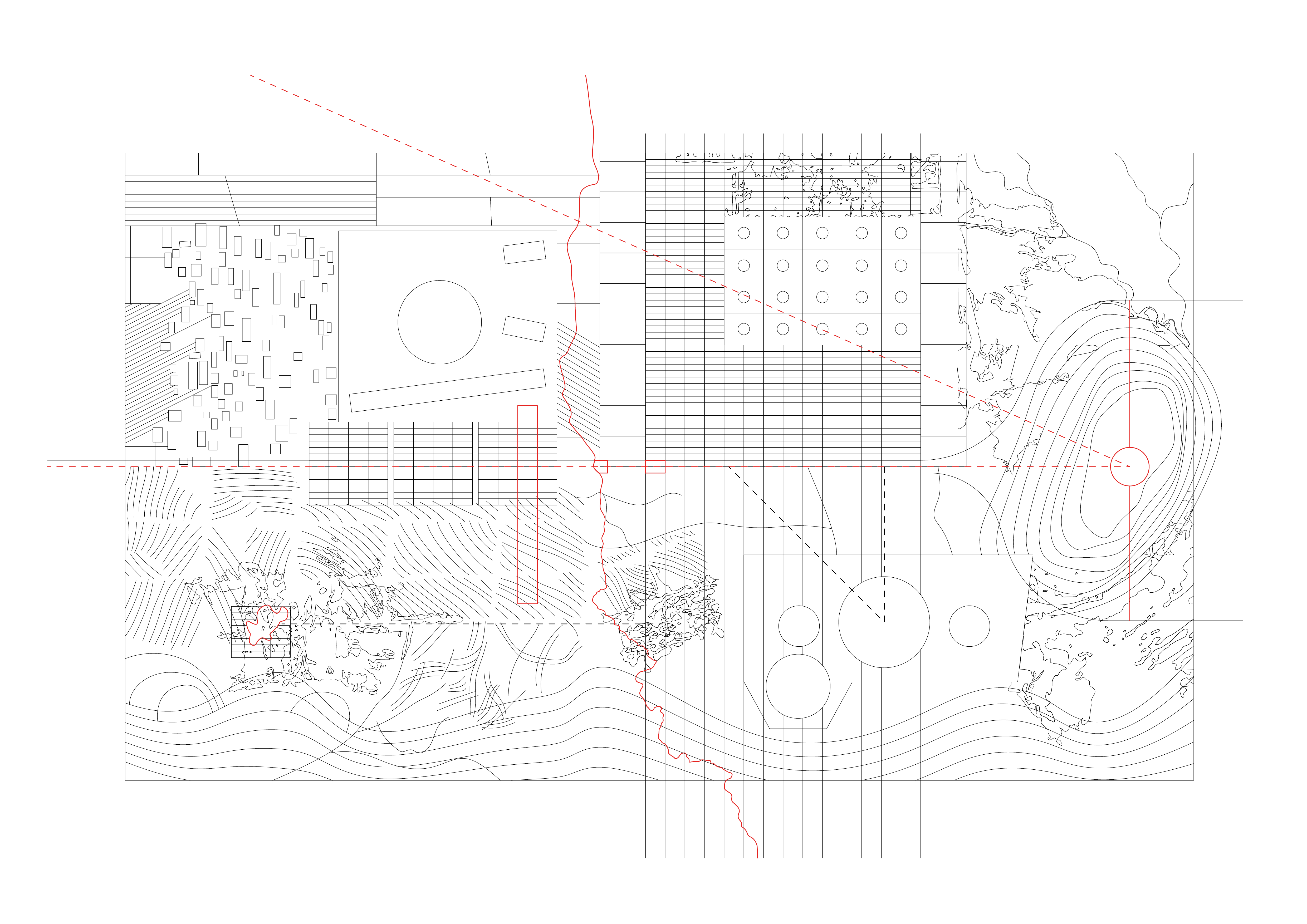
Topographies
Topographies, as detailed descriptions of the surface of a place, contain information about the forms and features of that piece of land of which local culture and history can be extracted. In the following mappings, the ways Mashhad deals with death is researched through its respective topographies. Topographical fragments of the territory around the highway are extracted, analyzed, re-assembled, extrapolated and in order to relate the respective fragments, and find sites which display a potential for mediation between the territories of the death and living.
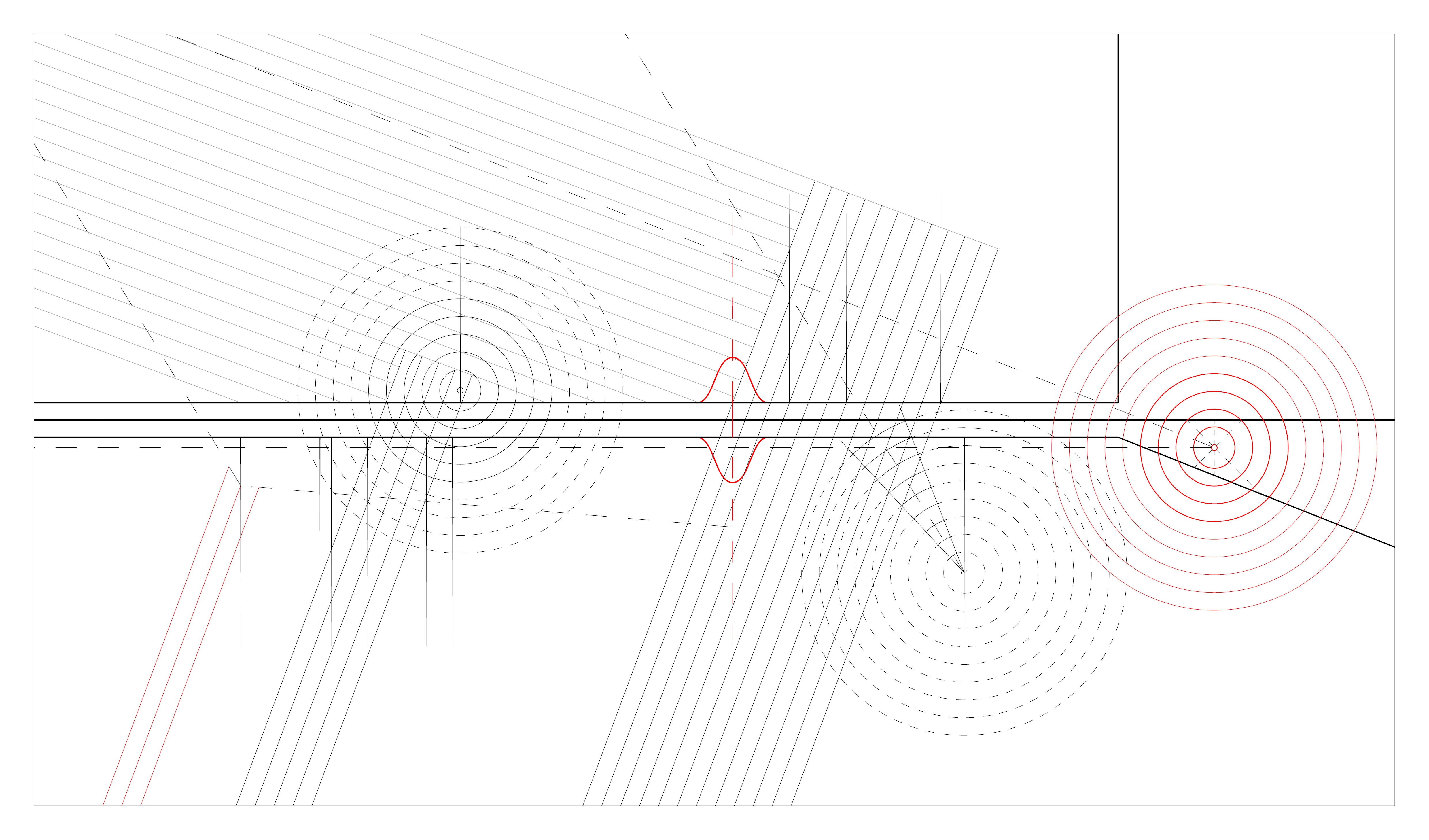
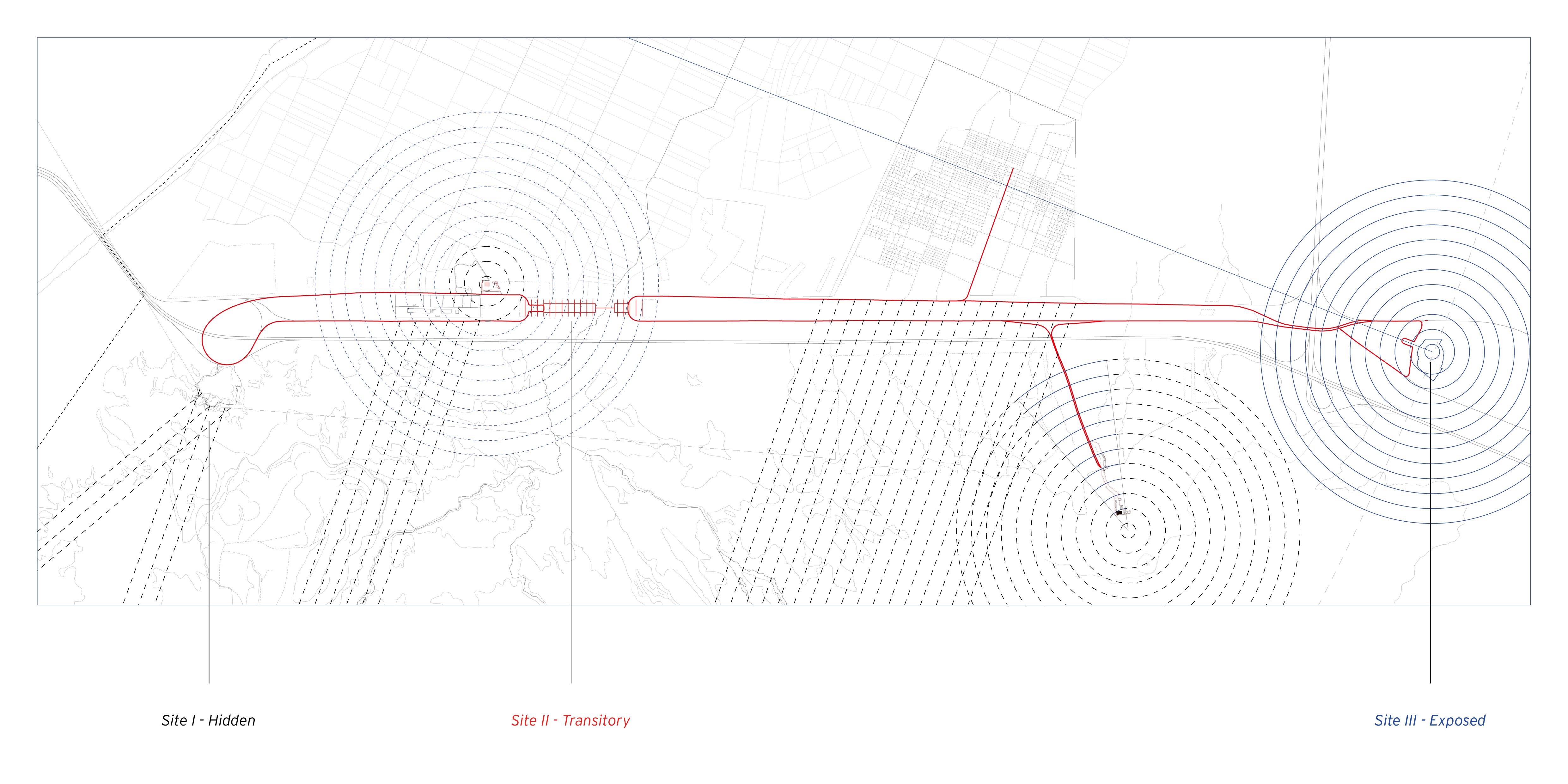
Sites of Investigation
A distillation of the topographical mapping represents the territory as a constellation of fields (cemeteries), points (shrines) and lines (the highway). Three sites within this system are chosen for further investigation: a hidden field next to the waste dump, a moment of transition along the linear highway, and an exposed viewpoint at the top of a hill.