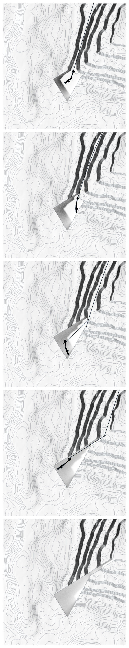
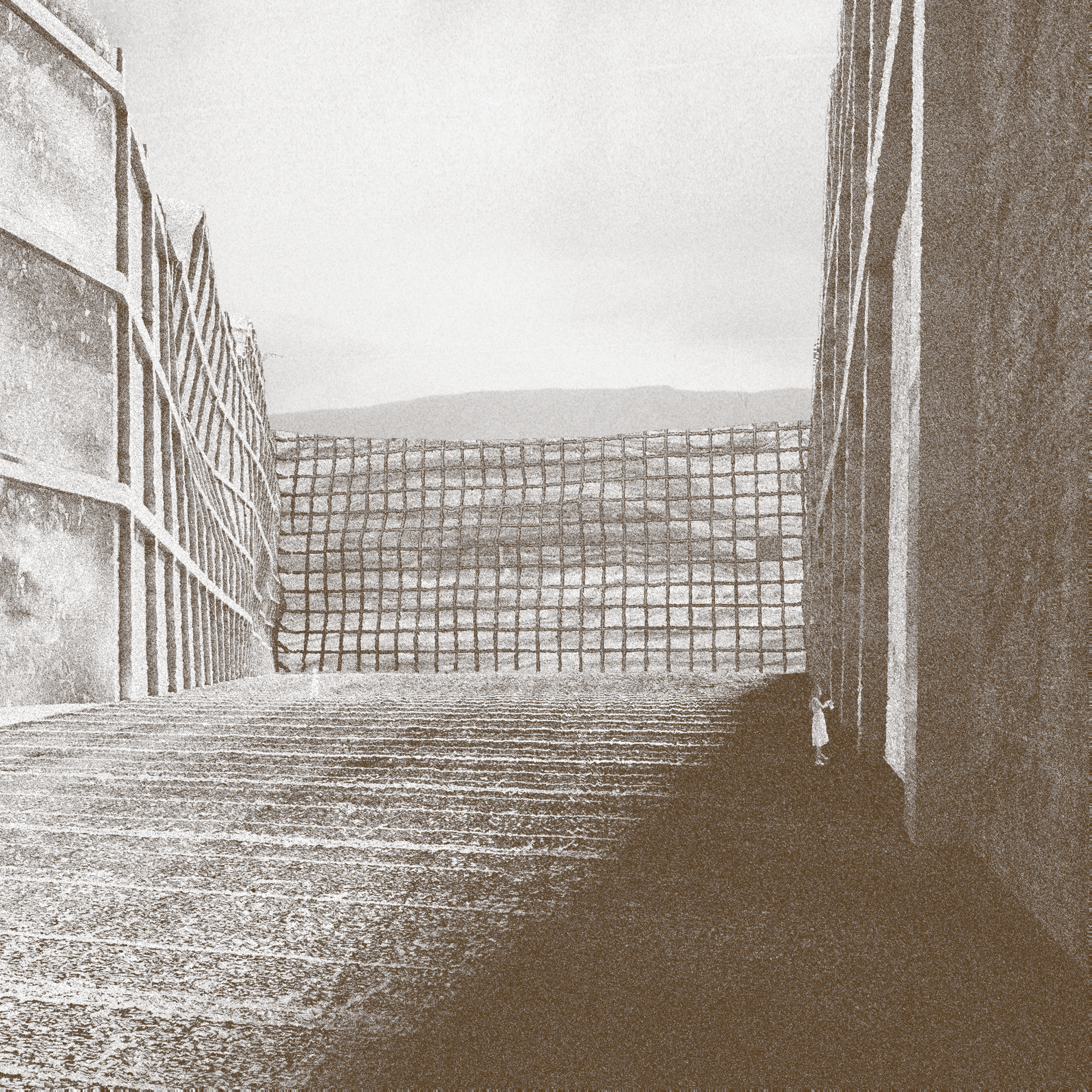
OBJECT 1: CRITICAL SECTION
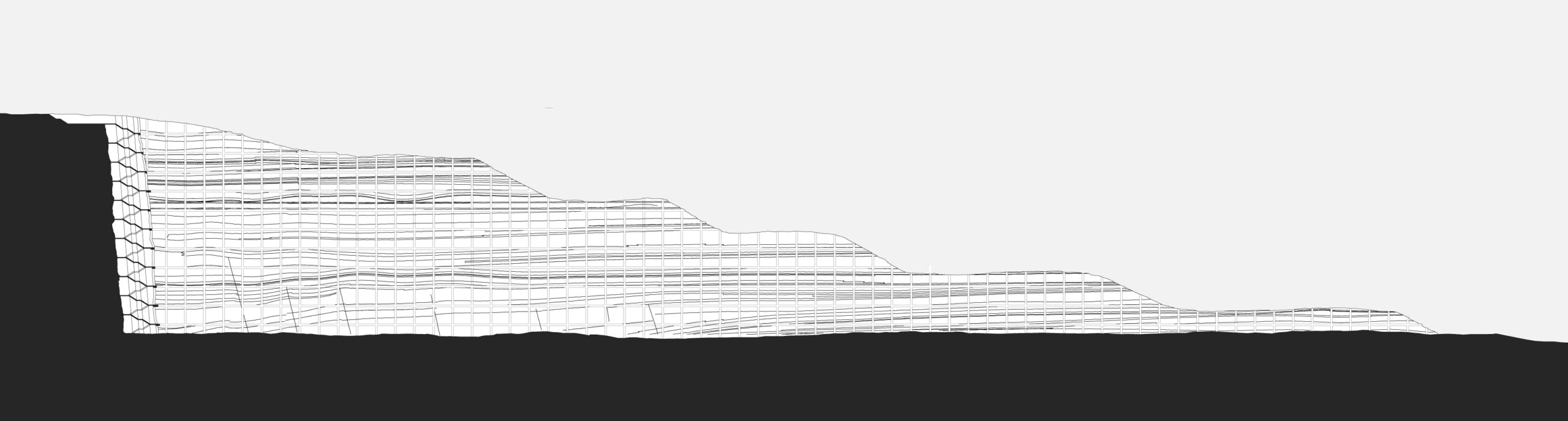
The critical section is a part of the landslide mitigation system. An intervention aimed to prevent further erosion of the soil incorporates a land-art design of a large soil-section profile. The site connects four temporalities: the untouched land; an archaeological site; the reminiscences of a former village; and the land in transition, via a vertical point of access situated in the corner of a section.
The intervention cuts into the grounds of the displaced Mavropigi village, to reveal its geological layers, the temporalities of neolithic settlements, as well as the communities’ displacement, allowing for observing and understanding the territory of the Ptolemais Basin.
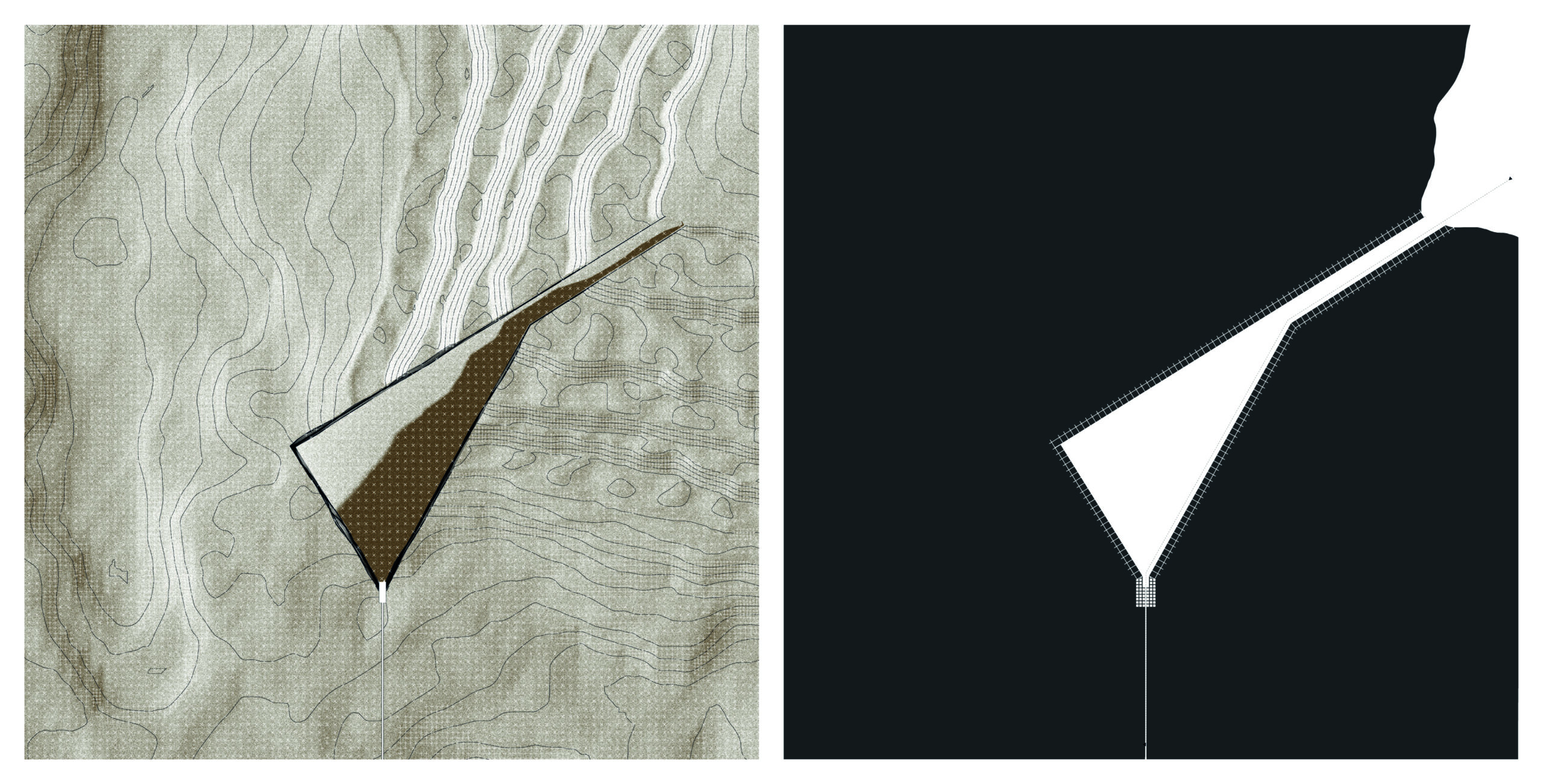
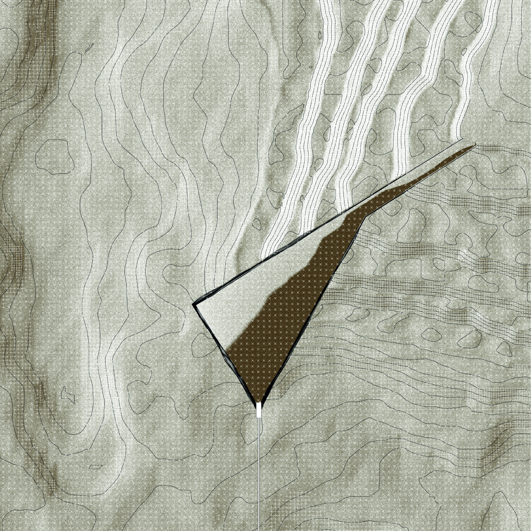

Past and present are revealed and connected, by means of the cutting tool – bucket wheel excavator. Starting from the highest level, the machine consequently cuts out a piece of land, which is held in place by means of a concrete grid. The shape of the cut allows one to experience both large and small scales used in geologic research. The 10x10m grid provides a framework for changing layers of the ground. In the corner, the old archaeological grid hosts an entrance to the vertical connection between the temporalities.