THE POINT OF EXHAUSTION
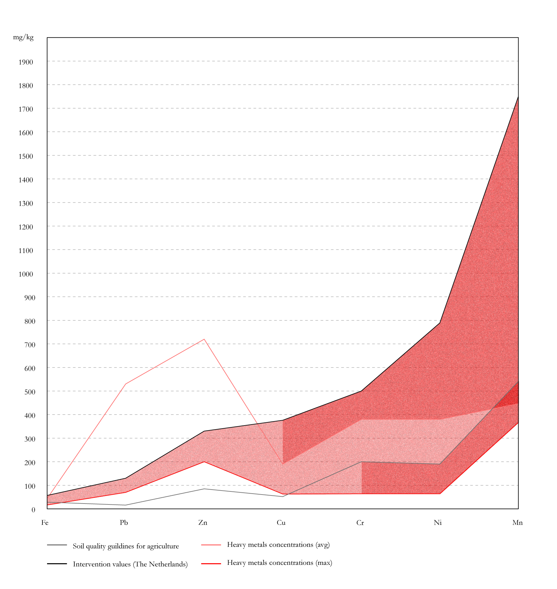
The closure of mining activities does not stop the consequences. The exploitation of the land has numerous environmental impacts, including modification of morphology, topsoil removal, fly ash production, radiations, surface run-offs, water contaminations, and concentration of toxic substances in soil and water.[34] As a consequence, the region suffers from changes in hydrological patterns, loss of wild animal habitat, water pollution, air pollution, irrigation problems, aquatic life disturbance, and general life quality degradation.[35] The most significant effect is related to the combustion processes of lignite, heavily polluting the air and contributing to the greenhouse effect, as well as the rising of cancer cases in the region by 16% since 1950.[36]
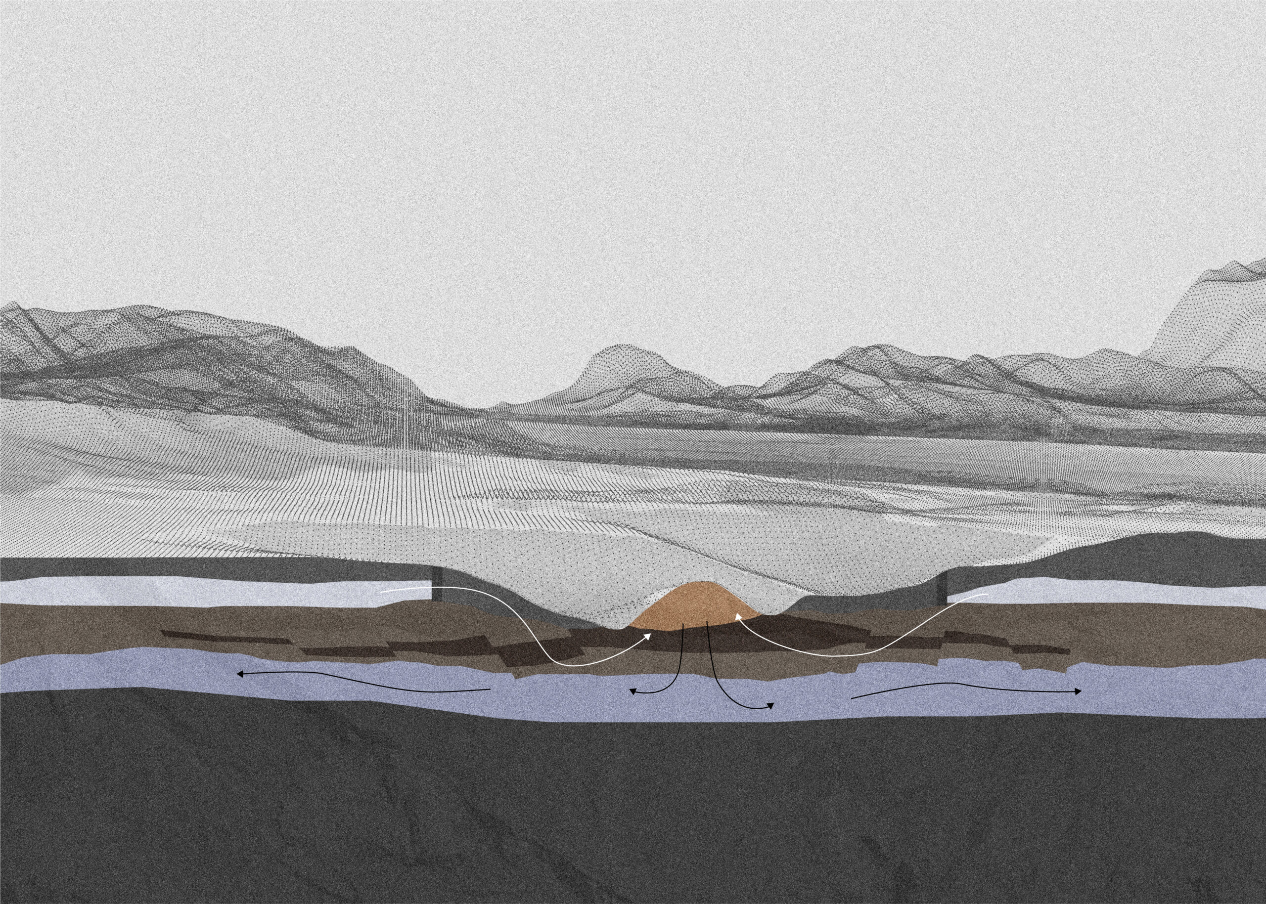
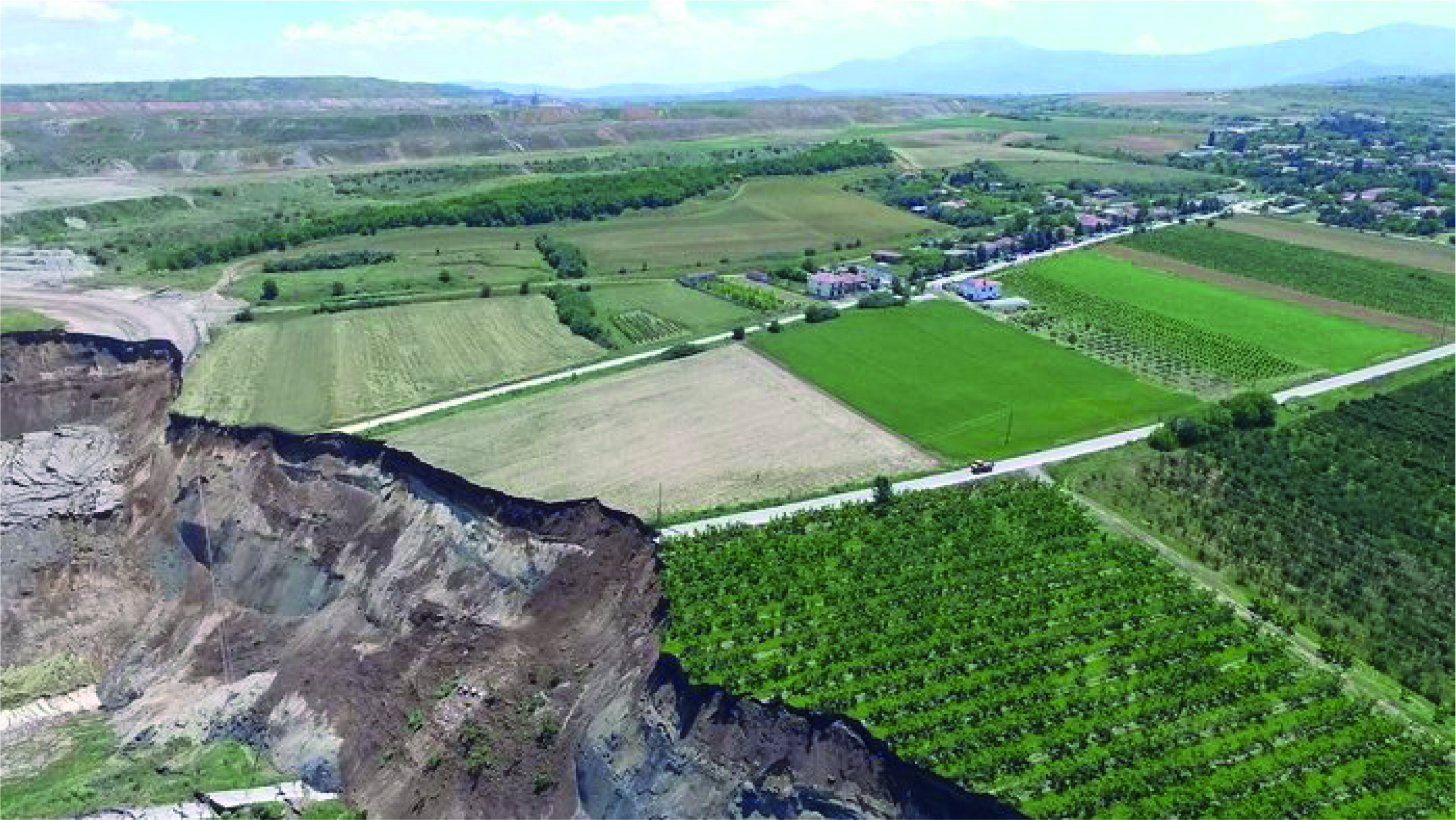
The mining activities have left the land scarred. Many villages are under the threat of landslides. Several of them already happened in the past. The biggest one, in Anargyri, moved 80 million cubic meters of soil, leaving the neighbouring village unsafe and dangerous and, therefore, dysfunctional. The aquifer that influences the mine and is exploited by the pumping wells is located in the Neogene and Quaternary sediments and lies above the lignite layer. The water-bearing formations, which affect the mine works, are the permeable sands and sandy layers of the yellow and green-grey series. In a simplified approach, they form two independent aquifers separated by clay and marl. However, on a large scale (i.e. the scale of the entire basin), they are connected hydraulically due to faults bringing them in contact with the permeable layers or due to diminishing the thickness of the impermeable layers. In order to extract lignite, the waterbed in Ptolemais is lowered. Extensive pumping takes place; approximately 8-10*106 m3/y are drained out for the dewatering of the open pit. Water from the sumps is also pumped out of the mine (6- 8*106 m3/y) and is discharged to the Soulou stream or used for covering irrigational needs. In total, 43835 m3/day of water is pumped out of the mine, which is the equivalent of 17,5 Olympic swimming pools. This changes the hydrological pattern of the entire region.
After the future mine closure, water will no longer need to be pumped. This will result in the waterbed reaching its original level, flooding parts of the mine. The raising of the groundwater table poses a threat to the region of the Ptolemais Basin. Contaminated with heavy metals, landfilling zones will be flooded after the mine closure. Due to the absence of a sufficiently impermeable layer, this may result in polluting large underwater aquifers, affecting the surrounding region.