THE CRITICAL ZONE
As previously speculated in the idea of the territory as a sensing device, our territory and Earth is wrapped in sensing devices. We use planetary scale sensing to measure the world, index the world, map the world, sense the world and detect (climate)change. This change happens in the Critical Zone. Here, the large-scale processes and Hyperobjects that occur at Earth Magnitude have a significant impact on Earth’s geology and ecosystems. This generates the program of the project; A Critical Zone Sensor.
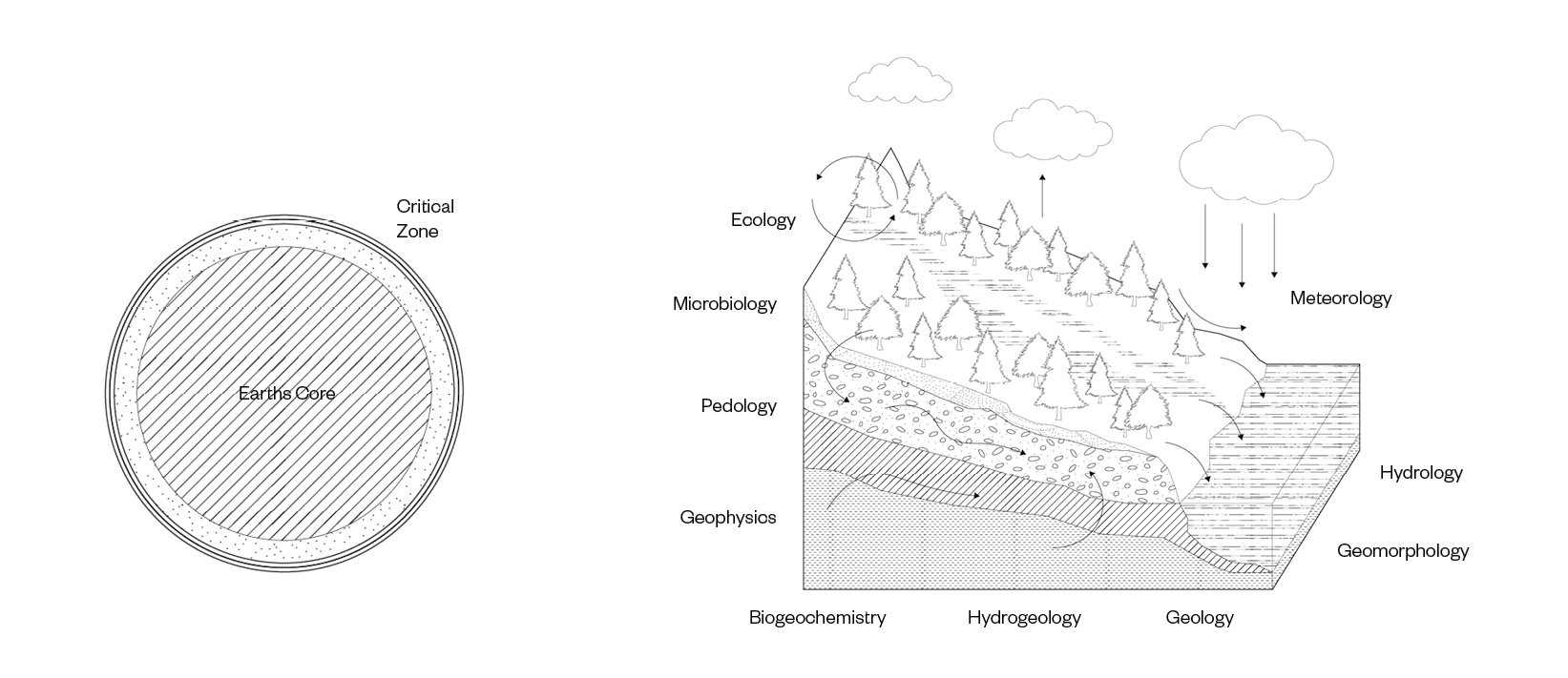
As theorized by Bruno Latour, the Critical Zone is a thin layer of several hundred meters thick above and below the surface of our planet in which human activity has a significant impact on earth’s geology and ecosystems.[14] The Critical Zone is the “heterogeneous, near-surface environment in which complex interactions involving rock, soil, water, air and living organisms regulate the natural habitat and determine the availability of life-sustaining resources.”[15] The Critical Zone is studied at Critical Zone observatories. Here, Critical Zone science aims to integrate multiple environmental disciplines such as geology, hydrology, geochemistry and ecology to understand the Critical Zone as one heterogeneous and complex system.
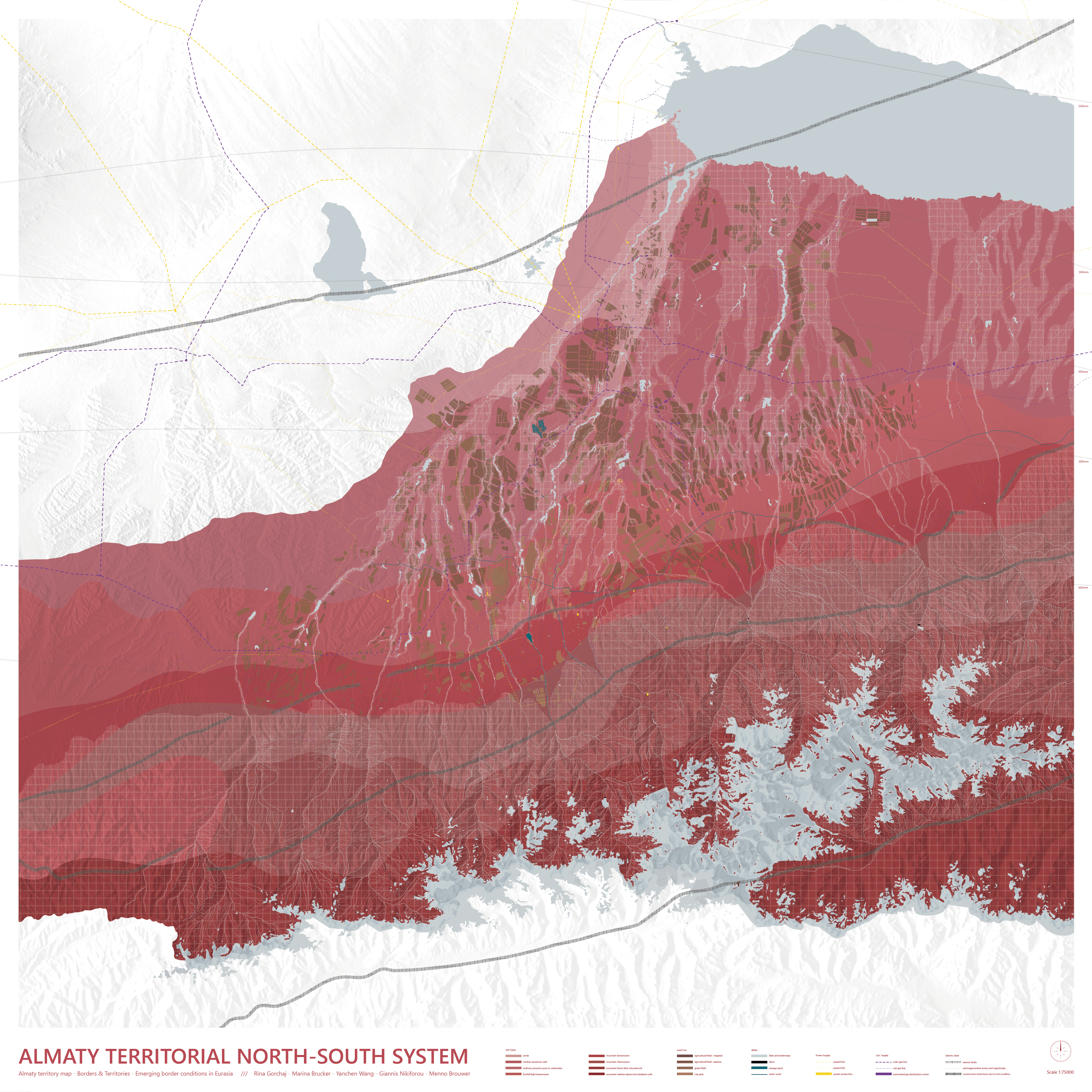
The chosen site is Almaty’s most critical zone. As it was stated in the introduction section, the base of Almaty’s territorial system is formed by the water infrastructure as generator and most important resource of the territory. The glacial lakes and mountain rivers are the origin of this water system and can thus be considered as Almaty’s most critical zone and site of the project.
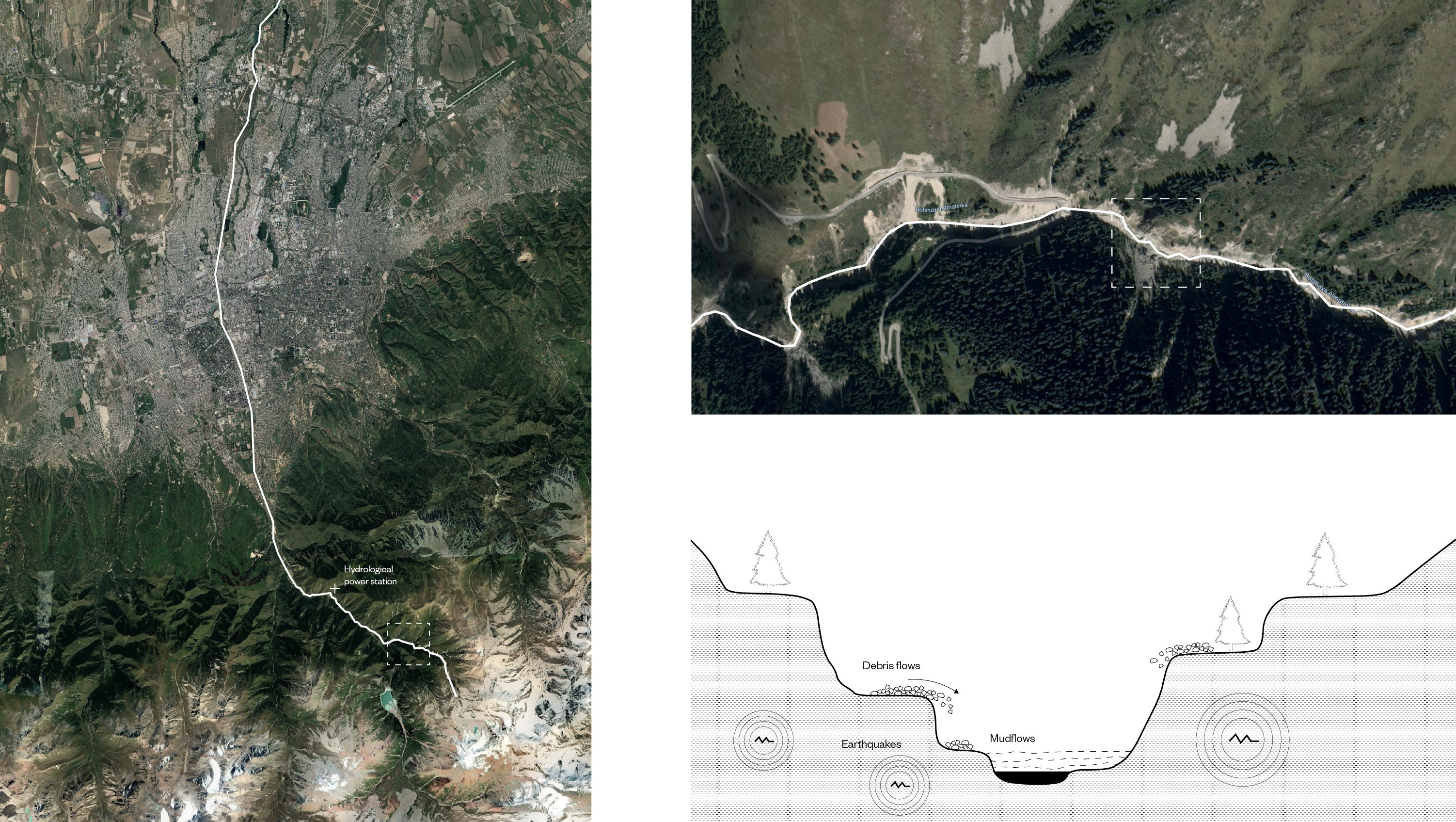
The specific chosen site is the Bolshaya Almatinka river. This river originates as a glacial lake and is one of the main rivers running through the city and further into the territory. This river is of specific importance for its hydrological power station downstream. The site is characterized by natural hazards such as earthquakes, mudflows and landslides and has a specific spatial characteristic of a canyon like section.
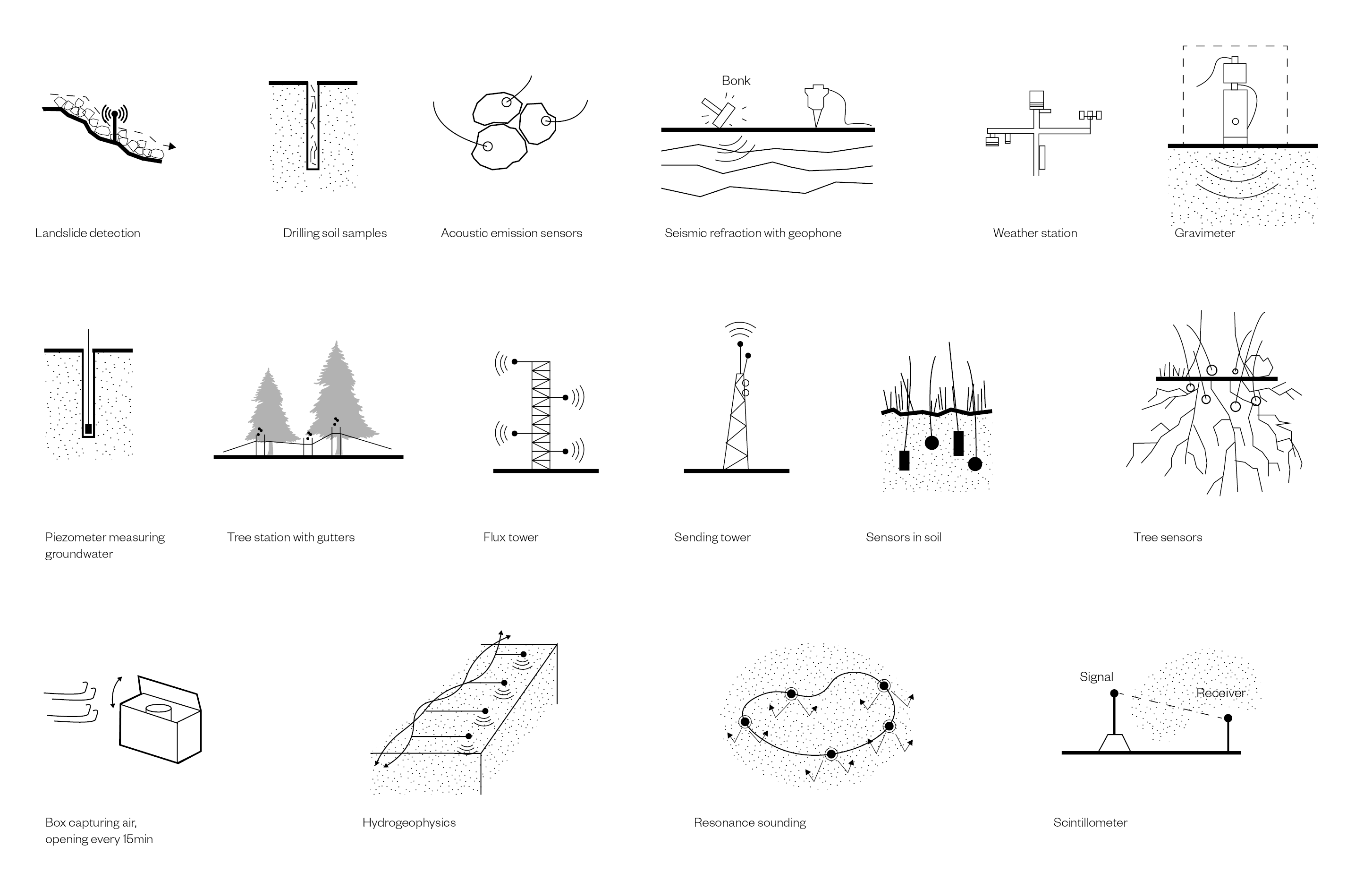
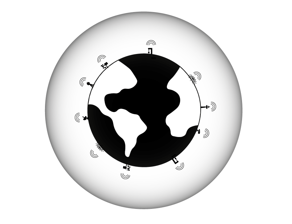
TCritical Zone science is conducted through a wide variety of sensing devices and monitoring instruments.
An investigation into the sensing devices used in Critical Zone science has been made through an inventory, based on Alexandra Arenes Gaiagraphy.[16] This inventory includes devices such as acoustic emission sensors, gravimeters, atmospheric sensors and seismometers. The inventory reveals the large amount of sensing devices used in critical zone science, their specific conditions and required infrastructure. The project facilitates these different sensing devices and combines them in one single project to understand the Critical Zone as one complex system.
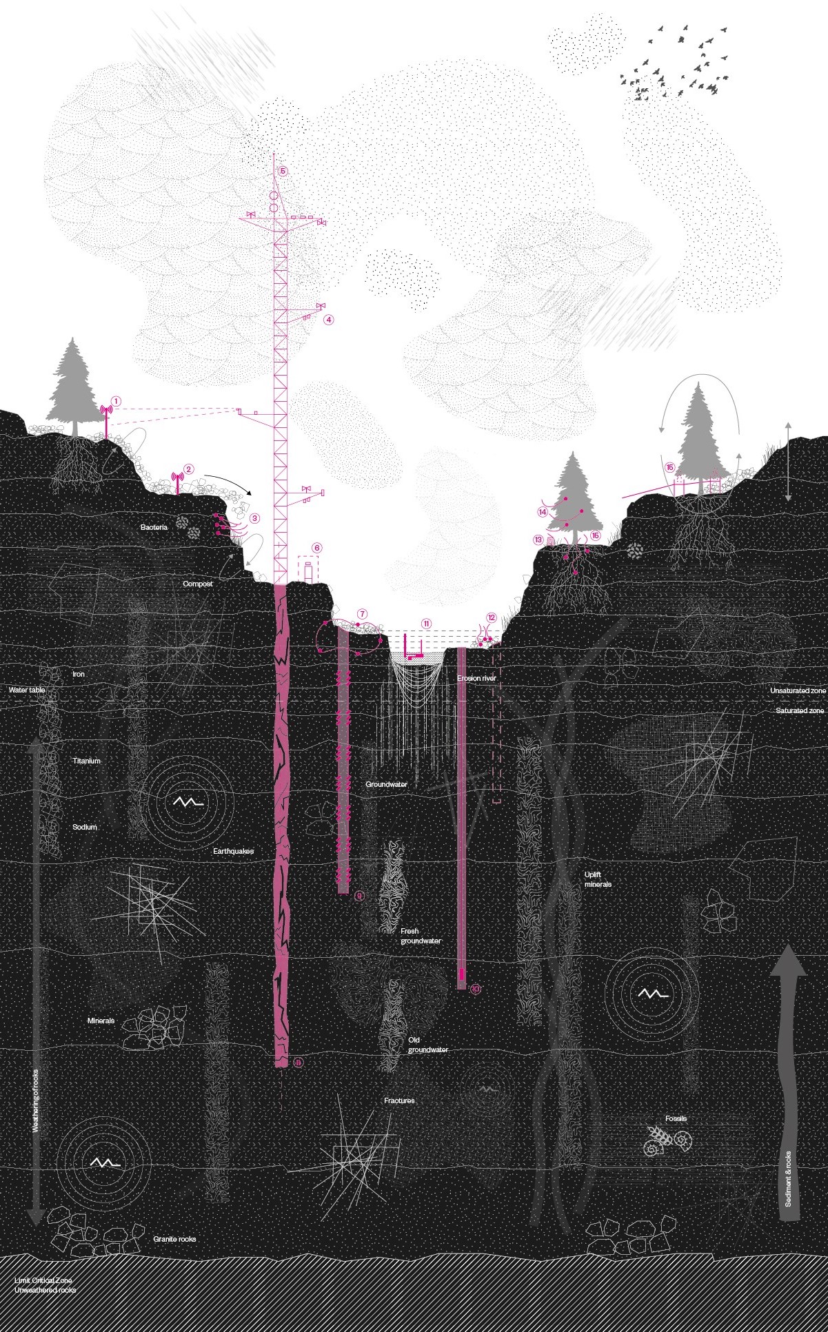
The inventory of sensing devices has been projected in a mapping of the Bolshaya Almatinka Critical Zone.
The sectional mapping is restrained to the limits of the Critical Zone, from the unweathered rocks in the earth till the atmosphere. The mapping includes the wide variety of processes and conditions that define the Critical Zone such as: erosion, groundwater, compost, minerals, weathering of rocks, roots, bacteria, atmospheric humidity etc.[17] The mapping reveals the Critical Zone as one heterogeneous and highly complex zone with an entanglement between beings where different processes and sciences come together. The mapping encourages us to think about the positioning of an architectural project in relation to all these non-human processes and conditions.
The projection of the sensing devices shows their placement in the site and their required conditions. The sensing devices are spread throughout the canyon and are drilled down into the earth, suspended into the atmosphere and distributed sideways in the section. This projection of the sensing devices and their required conditions form the base of the design project.
Project intention
The project distributes the sensing devices used to research the Critical Zone in one single project and aims to integrate the multiple environmental disciplines of Critical Zone Science to understand the Critical Zone as one heterogeneous and complex system. The project encourages us to think about our human influence on the planet, how we can better understand our environment and how to position an architectural project in relation to non-human conditions in a time of environmental crisis.