ALMATY – A TERRITORIAL NORTH-SOUTH SYSTEM
The context for the project is the territory of the former capital of Kazakhstan, Almaty. Almaty is distinguished for its complex political and demographic history. Its position on the northern foothill of the Tien Shan mountain range provides a favorable humid continental climate. The height of the mountain range has led to the creation of a prolific bio-system, establishing the region as environmentally significant in a country composed predominantly of desert landscapes.
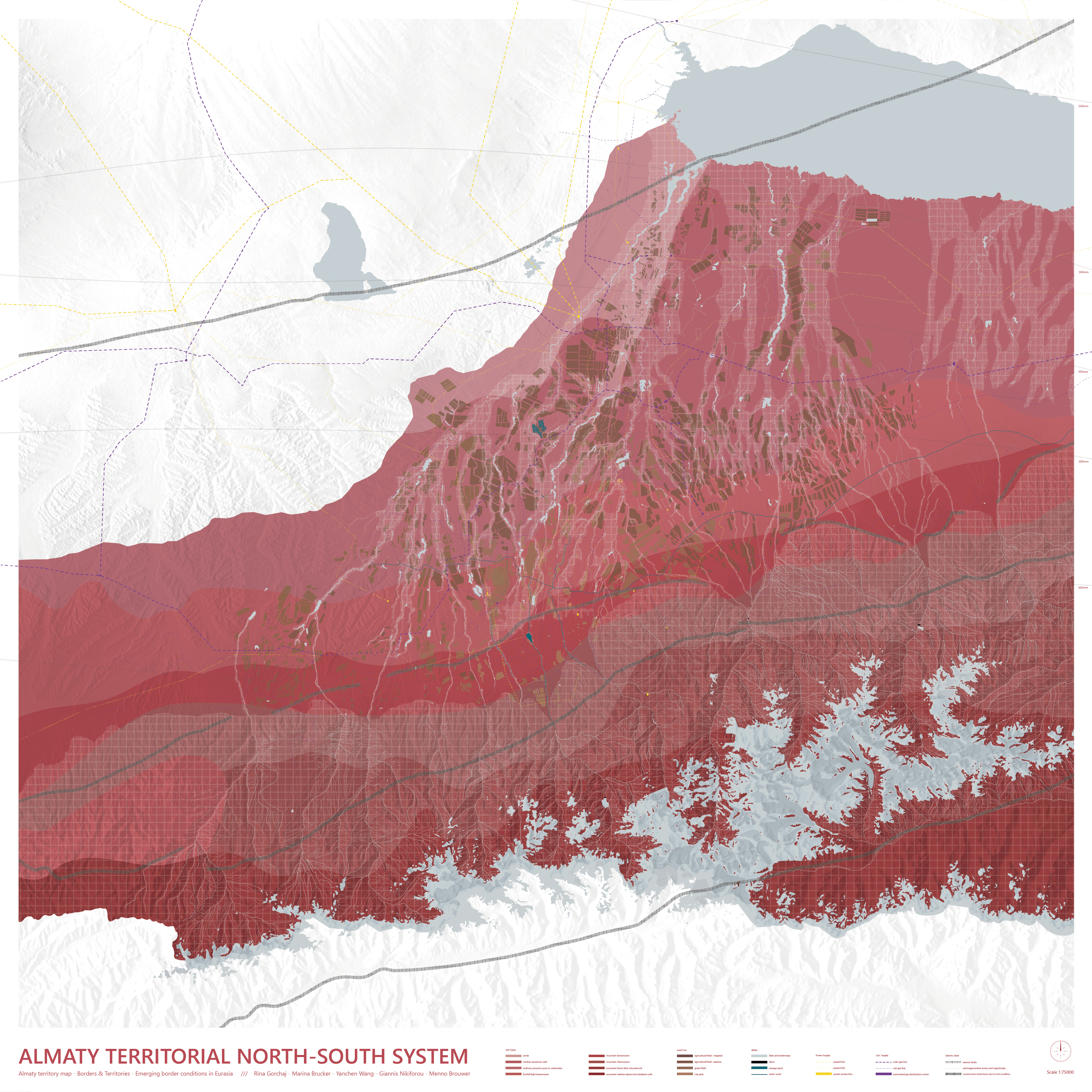
The project started with a collective research on the territory of Almaty. During the collective research, a certain north-south expansion of the city became apparent which formed the departure point of the understanding of the territory. Consequently, the city fabric has been removed from the map in order to understand the territory as a autonomous system without any prejudices from the urban fabric. Instead, the map portrays the material conditions that shape the territory as a north-south system such as water infrastructure, soil conditions and territorial hardware like pipelines and power supply.
Additionally, due to the increased water volume, there is a larger moisture content in the soil which makes the ground rather unstable. These conditions together form territorial risk zones which follow the rivers. However, the water and soil conditions allow for a great number of irrigated agricultural fields. This high density of agricultural fields is unique for the rather dry Kazakhstan and they are important for the city’s economy and livestock.
Human interventions in the form of canalization, dams, and mud stoppers have been made in water system to avoid mud-related disaster and water and sewage treatment plants service the city’s infrastructure. Along this system, electricity is produced to supply the city, however, despite the hydroelectric stations along the rivers and in the Kapchagay reservoir the production is not sufficient. To fulfill these needs electricity and gas is further imported in the city through territorial hardware. The composition of the territorial hardware creates a canyon like shape leaving voids on the east and west of the territory while further strengthening the north-south system. Finally, the extend of the map is cut to the understanding of the territory of Almaty as a north-south system of material conditions.