97 FOLLIES OF THE PACIFIC OCEAN
‘Americae Sive Quartae Orbis Partis Nova Et Exactissima Descriptio’ is the title of this exceptional map from 1562. Notably, the map presented shows a rather strangely shaped American Continent – at least, strange for us today. There is a conception that America has a shape, due to the prevalence of the common map that is drawn, but this shape is effectively non-existent in real experience, arbitrary and malleable. What remains rigid, however, is the logic used to create the drawing. A different logical representation would result in a different shape of America.
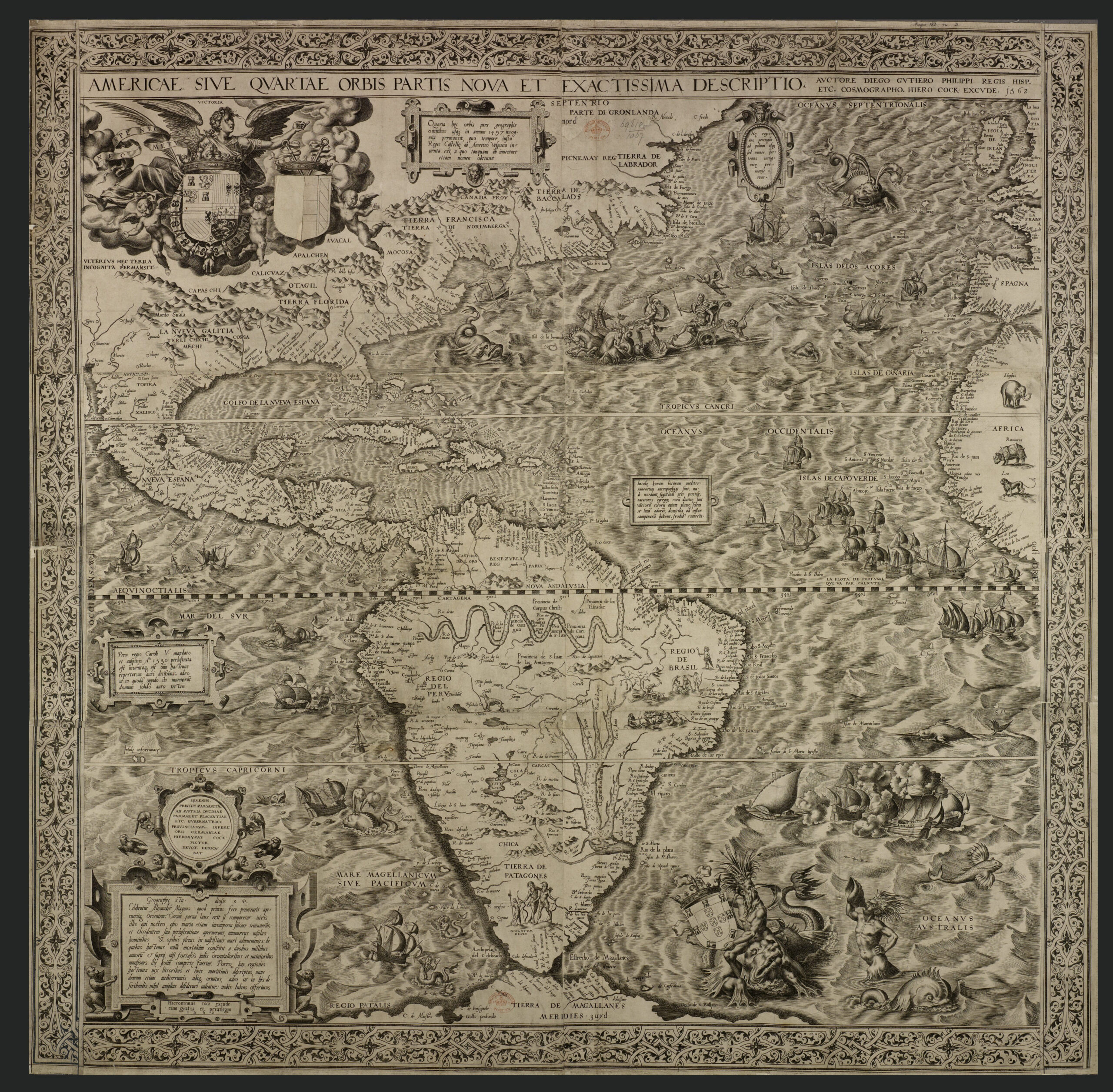
In English, the title of this map translates to: ‘A New and Most Exact Description of The Fourth Part of the World.’ This most exact description includes monsters, monsters of two types: First, there is the creature in the water- and second, there is this phantom bar running above the pacific ocean and the land, denoting the lines of longitude. I believe that the creatures in this map and others like it are not intended as literal descriptions, but rather as indications of fear and of the unknown, unseen and unfathomable quality that exists in those waters. Somehow, over the course of the last 500 years, we have done away with the conventional monster but have kept the much more sinister black and white checkered grid that now dominates our understanding of the globe.
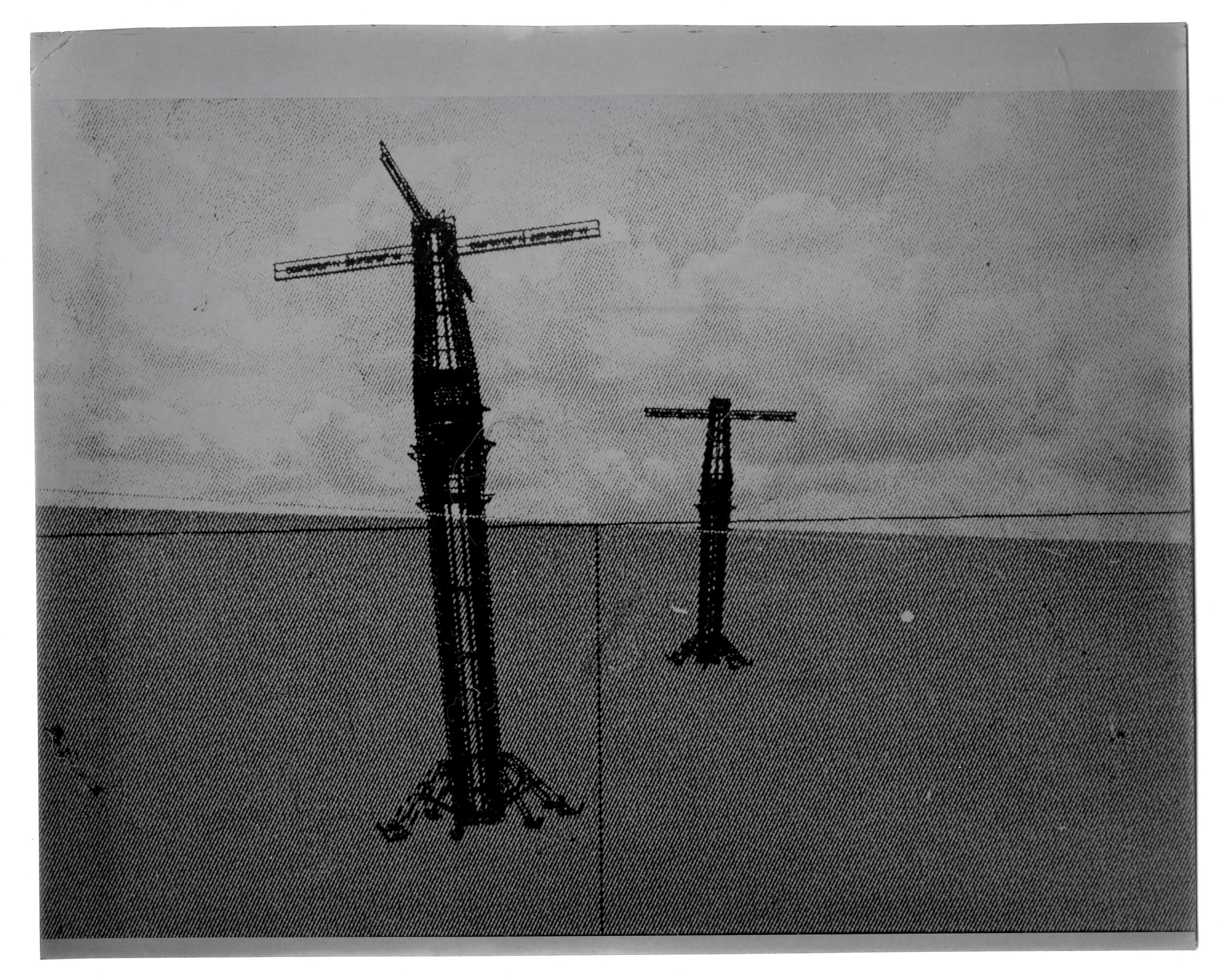
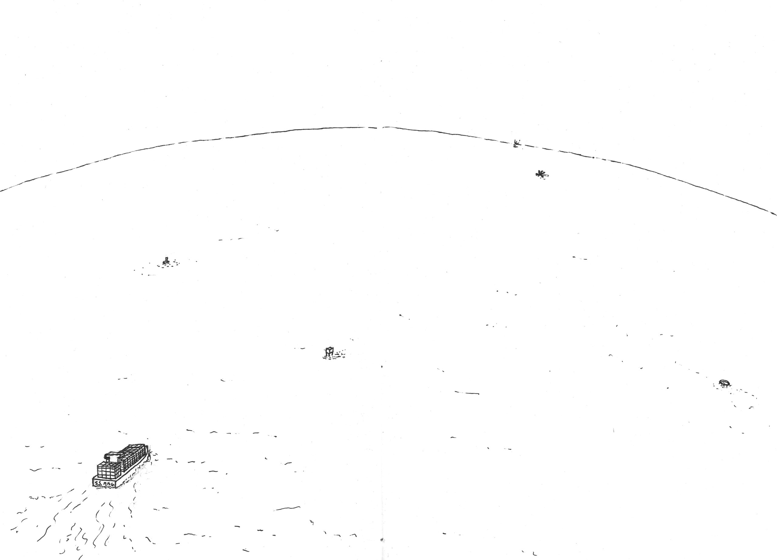
The project places a floating structure at each of the coordinate points of the 10 maps shown previously (see Figure 4) to act as markers, lighthouses, and objects of mystery and intrigue. Each structure contains a residential capsule that allows its resident to take qualitative measures of their specific location, necessarily at odds with the (quantitative, abstract) Cartesian system that places them there. In the evening, the findings of their measure will be broadcast to the world, allowing stranded and waiting Panamax vessels to listen to the stories of the far-away and strange waters they’ve recently sailed.
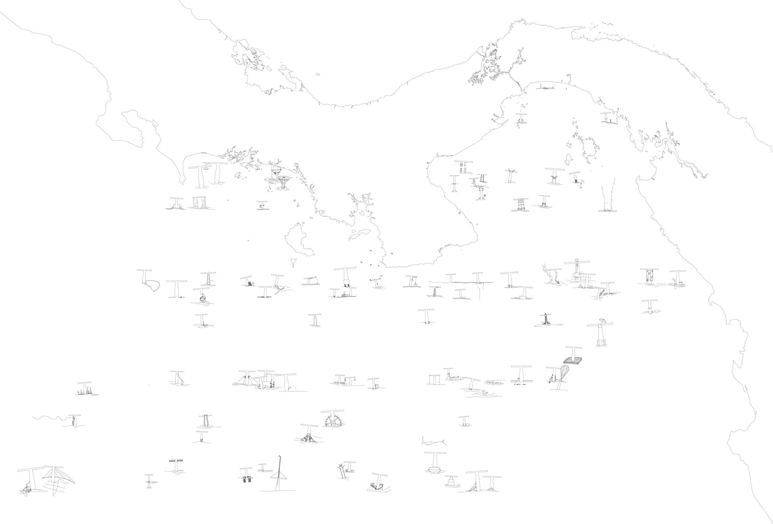
The 97 follies of Panama are arranged accordingly, representing the coordinate points of the different maps and enabling their resident to carry out qualitative superficial research. The index shows us the dates of the map, the coordinates according to that map, and the depth of the water at that point. It tells us what qualitative measure the structure will carry out at that point. As the water gets deeper, the measures conducted at the surface become more and more ‘unfathomable.’ These measures should be presented as written or otherwise documented experiences specific to the measure and the structure, not in terms of numbers or some other systematic measure that is extensible to other locations or repeatable across time.
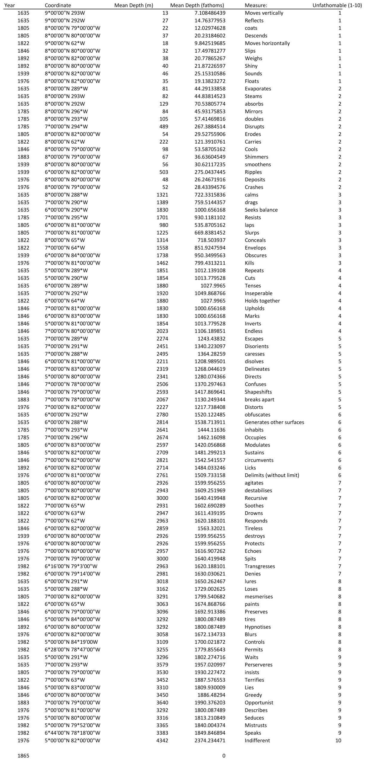
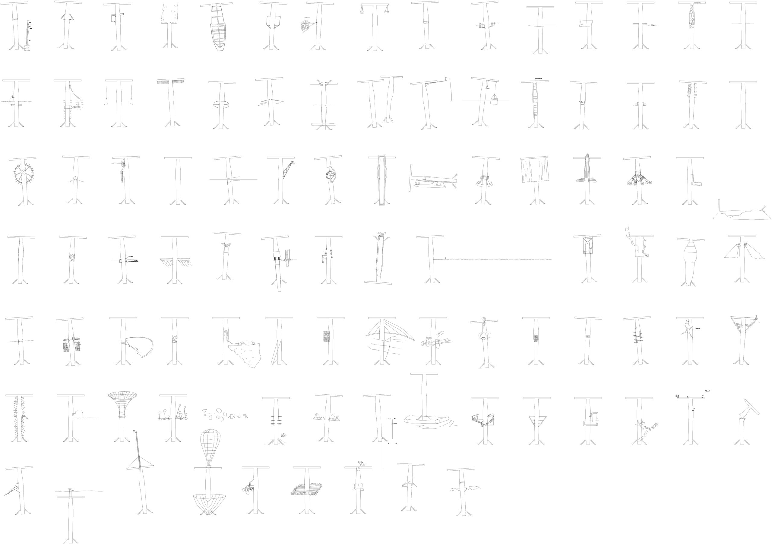
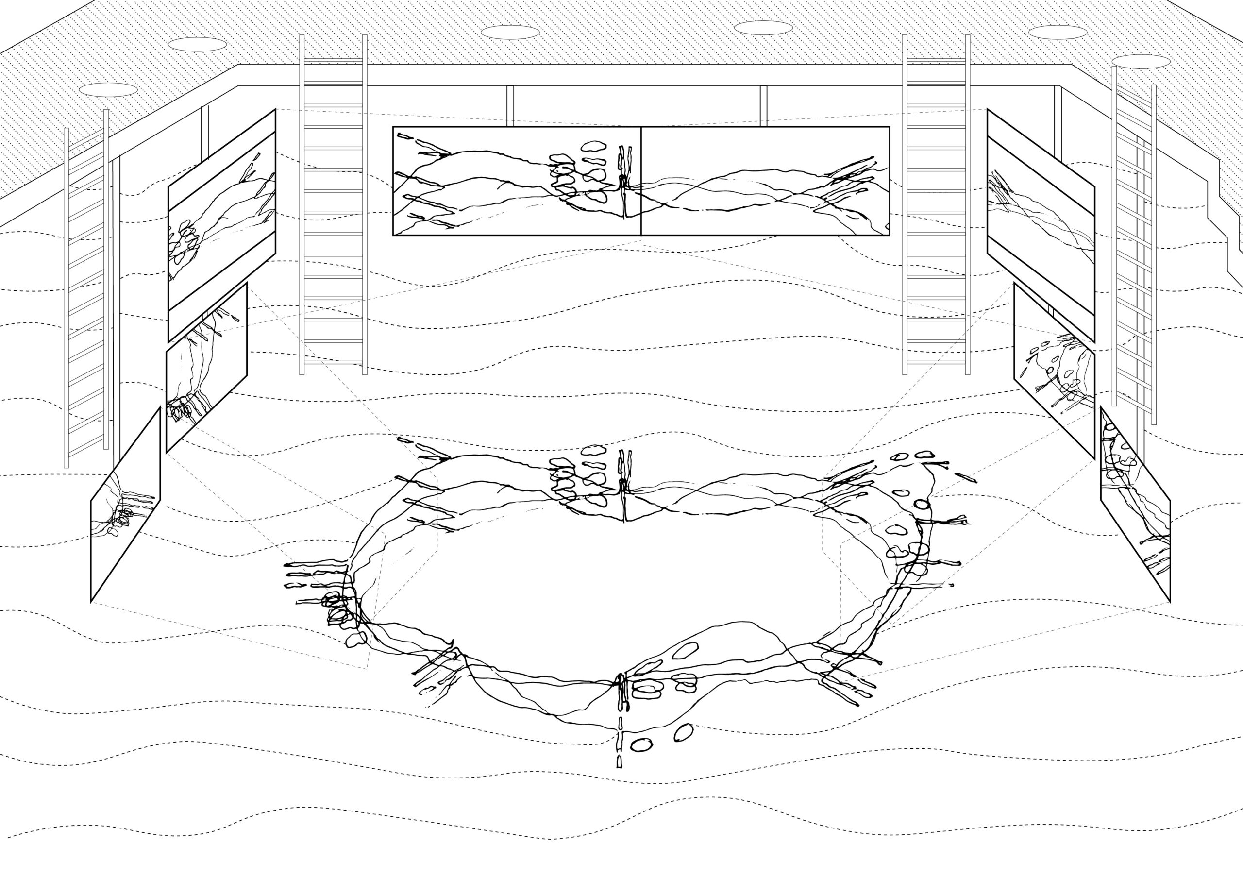
When shown as elevations, the 97 follies arranged in a grid show their similarity as well as their distinction. Architectural variances afford the experience of certain qualities of the water’s surface: The surface moves vertically, reflects, evaporates, steams, absorbs, calms, drags, seeks balance, repeats, cuts, tenses, is inseparable, escapes, disorients, caresses, obfuscates, generates, lures, loses, is opportunist, perseveres, mirrors, doubles, disrupts, resists, inhabits, occupies, agitates, descends, erodes, laps, slurps, modulates, coats, destabiles, insists, mesmerises, is recursive, moves horizontally, carries, conceals, responds, holds together, soothes, drowns, envelopes, paints, terrifies, dissolves, cools, upholds, preserves, inverts, is endless, confuses, shapeshifts, directs, is tireless, slips, sustains, delineates, marks, is greedy, lies, circumvents, tires, breaks apart, waits, shimmers, hypnotises, licks, is shiny, weighs, smoothens, ripples, sounds, obscures, destroys, deposits, spits, echoes, floats, describes, blurs, delimits, distorts, kills, crashes, seduces, protects, is indifferent, denies, controls, transgresses, permits, mistrusts, and speaks.
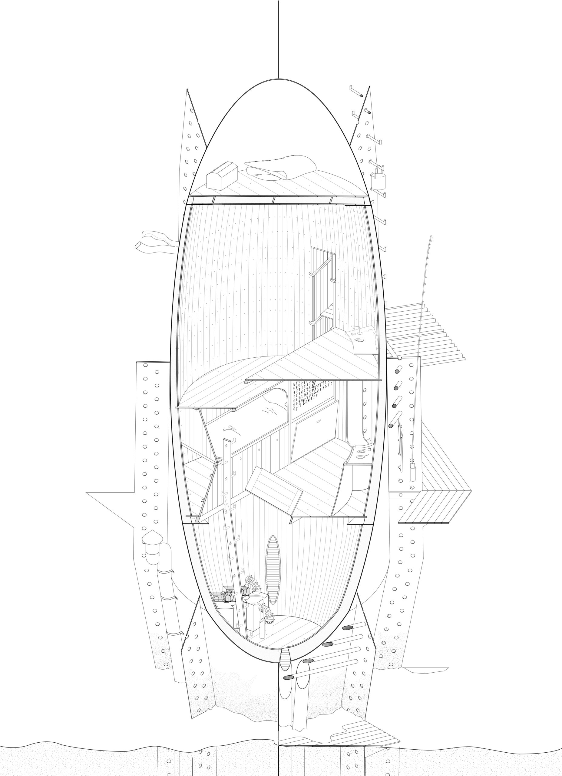
The variations that distinguish each folly revolve around a modular core that functions as a spar buoy.
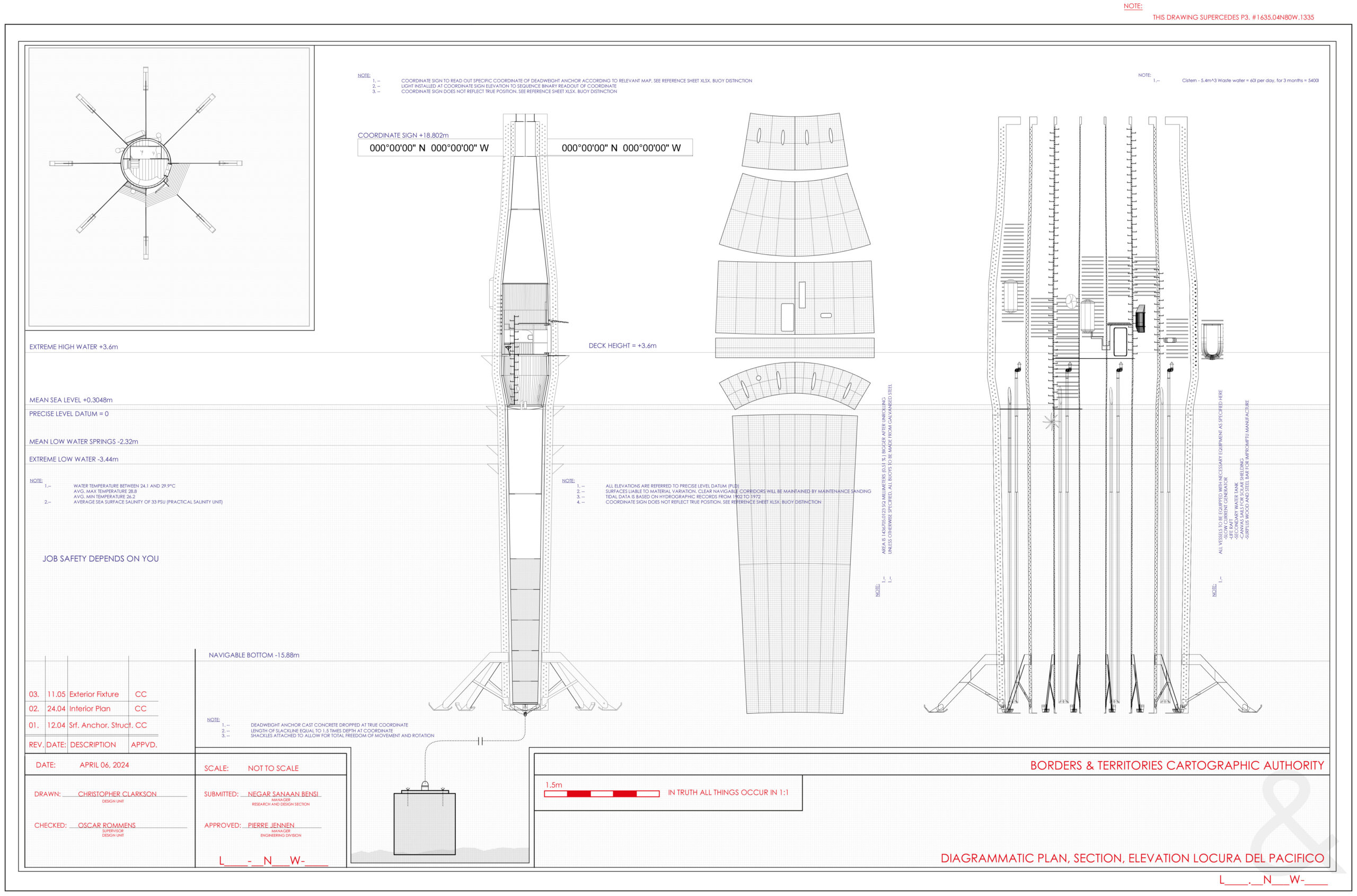
This technical layout presents (from left to right) the plan, section, surface map, and an inventory of fixtures on the exterior, along with the concrete deadweight anchor below. The plan shows the residential space – an ‘existence minimum’ residence for a solitary inhabitant. As a drawing, it is an exercise in the frame, utilizing techniques present in technical diagrams used to construct the Panama Canal. The section shows us the ballast tank, air tank, pump and technical room above which is the residence and a broadcasting station.
Due to the depth of the water, the moving surface and the anchor system, the coordinate grid itself lands elsewhere than the structure. Effectively, the design’s signage not only reads out coordinates of a map that is out of date, but it can also be incorrect by up to half a kilometer according to the site’s movements and specific conditions.
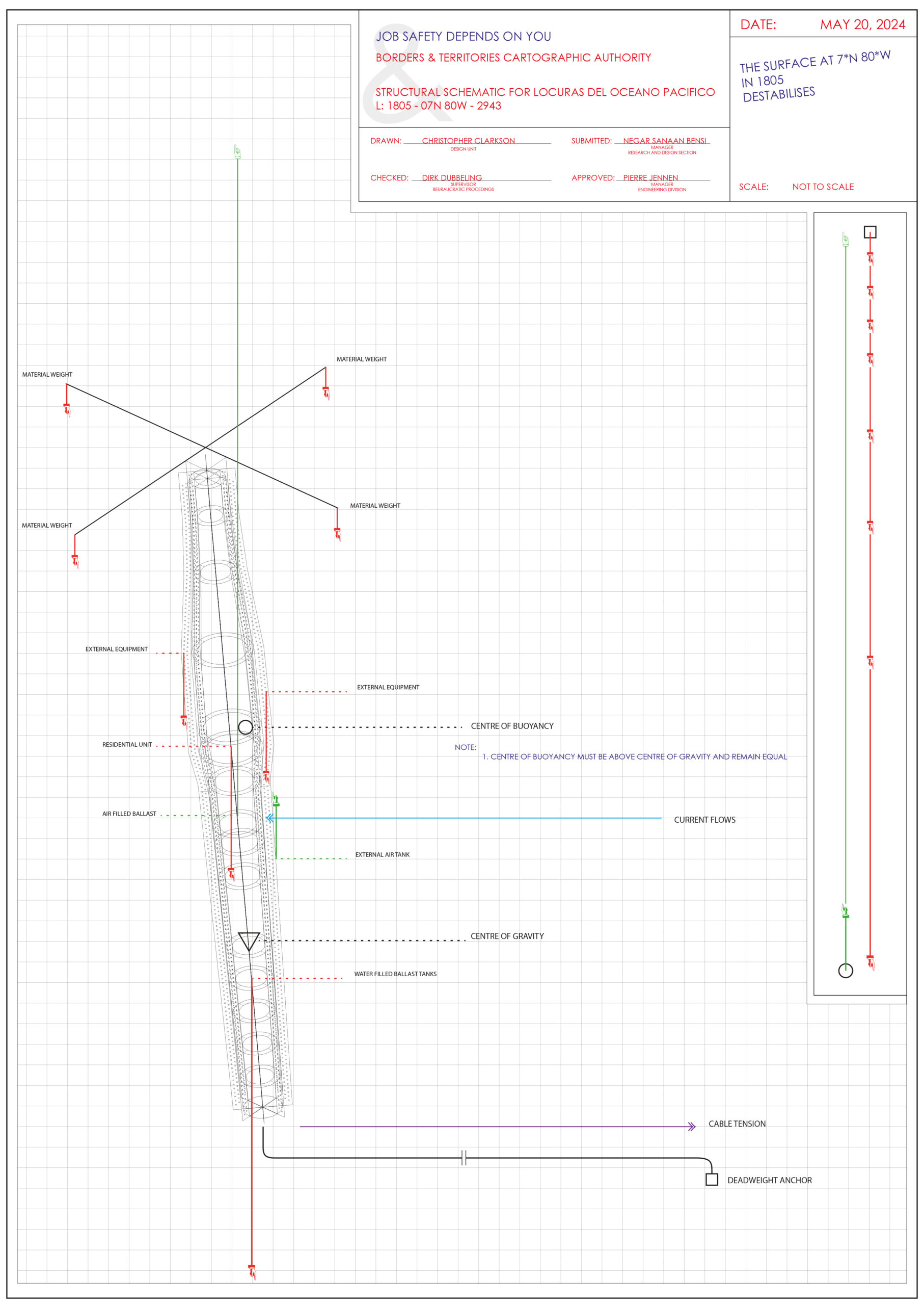
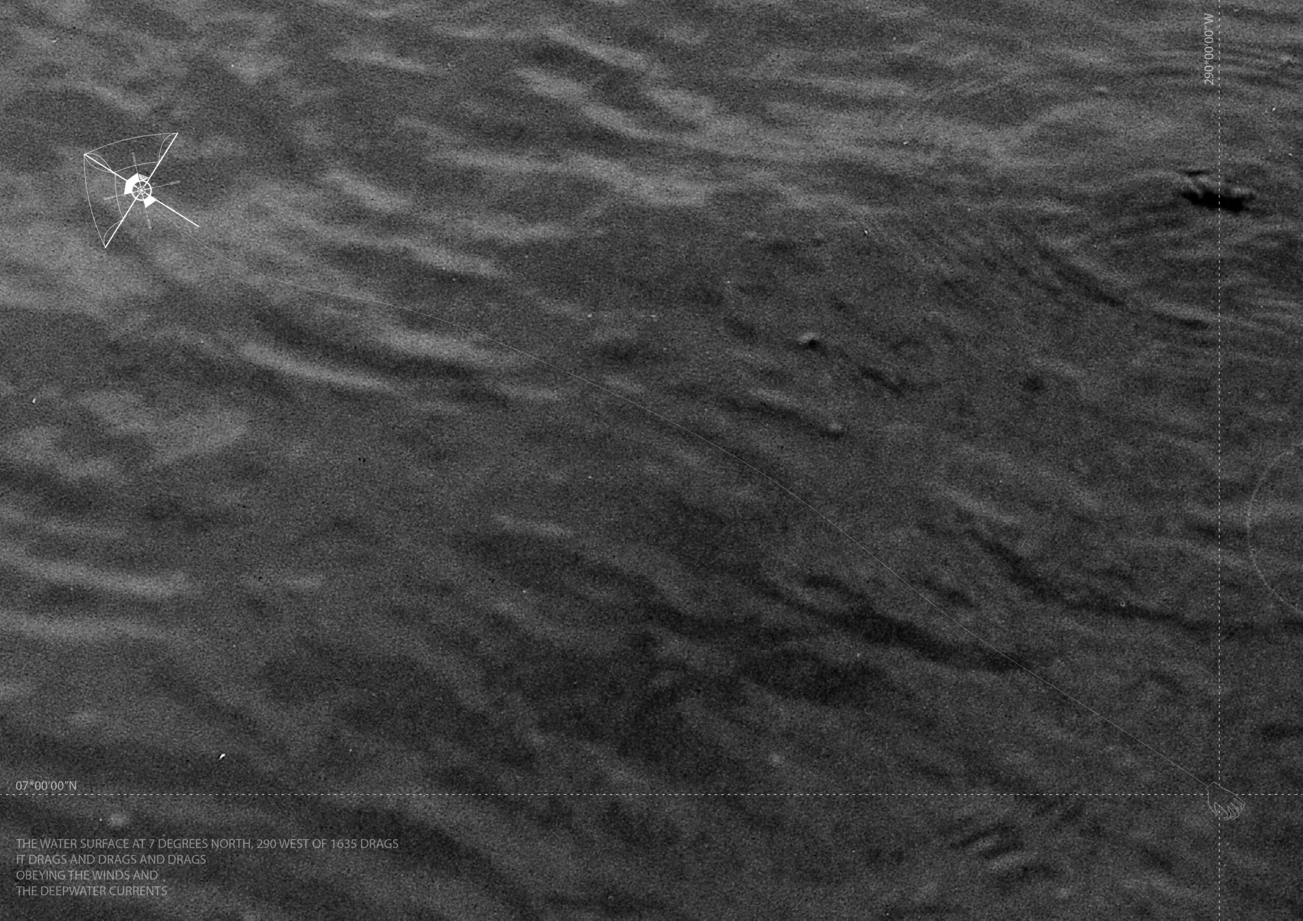
At 7˚N 80˚W in 1805, the surface destabilizes the structure, with external ballast tanks which create a constant state of misalignment.
At 6˚44’N and 78˚18’W in 1982, the surface speaks. The measure is carried out by translating wave amplitude into Morse code.
At 7˚N and 79˚W in 1883,
The surface… Waits.
The oscillating residential unit here drives a pendulum clock, necessarily resulting in the incorrect time, dictated by the surface’s disposition.
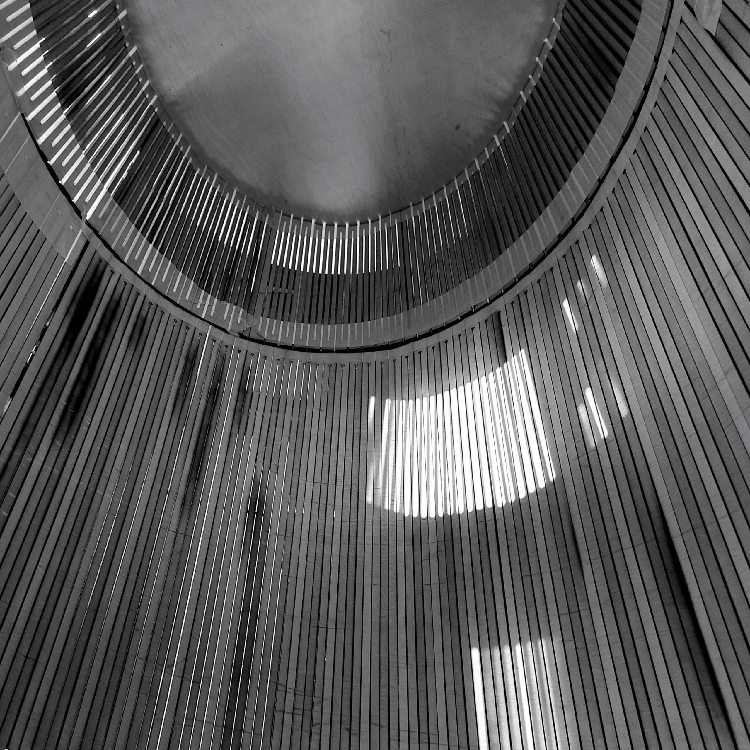
At 8˚N, 292˚W in 1635, the surface absorbs. The wooden structure absorbs water and therefore, as the wood swells, becomes water-tight below the water line. Above the water line, however, planks remain relatively dry to allow small amounts of light to enter the structure.
At 8˚N and 293˚W in 1785, the surface doubles. A shared anchor between two identical structures allows the residents to question in what ways they are identical or not, both in their position relative to their shared coordination, and in their mannerisms. At 8˚N and 293˚W in 1785, the surface doubles.
17.04.2026
At six degrees north, sixty-five west in 1822,
The surface of the ocean paints.
She is an expressionist devoid of expression,
Reminiscent of Rothko, but with the passion of Goya;
A sensitivity to those elemental qualities known only to Serra.
Transforming blues and greens and gunmetal silvers
Into fiery reds and oranges upon my hull’s exterior.
But beware of the oceanic clipping masks,
It drifts, invisible, and without hesitation
Will remove your ship’s mast.
The isometric view provides insight into the residential space, where technical facilities for pumping and energy are below, and living is above. On the third floor the resident broadcasts their findings of the day to the Panamax ships waiting to use the canal or otherwise abandoned by multinational shipping tycoons. In doing so the strange and unfathomable stories of the vast expansion of the ocean are told once again.
At 5˚N and 81˚W, in 1976, the surface describes. One continuous and ever-changing line surrounds the vessel, determines its shape and disposition by the second. It does so by tracing the line surrounding the structure where it enters the water. By a system of mirrors the resident is able to recreate this line.
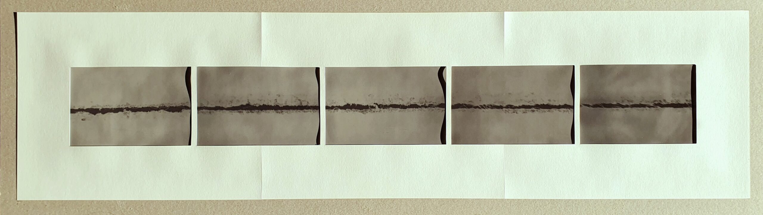
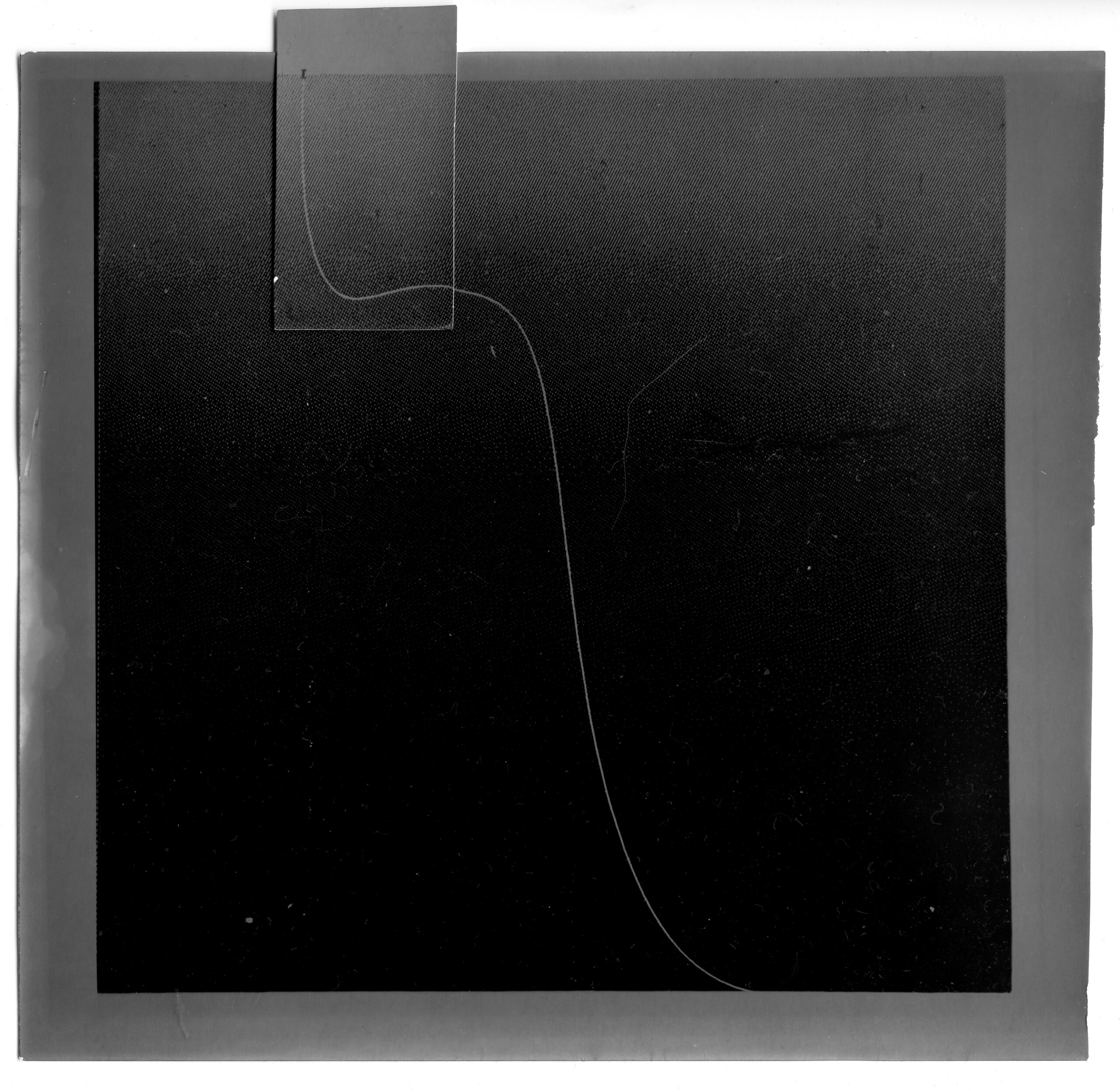
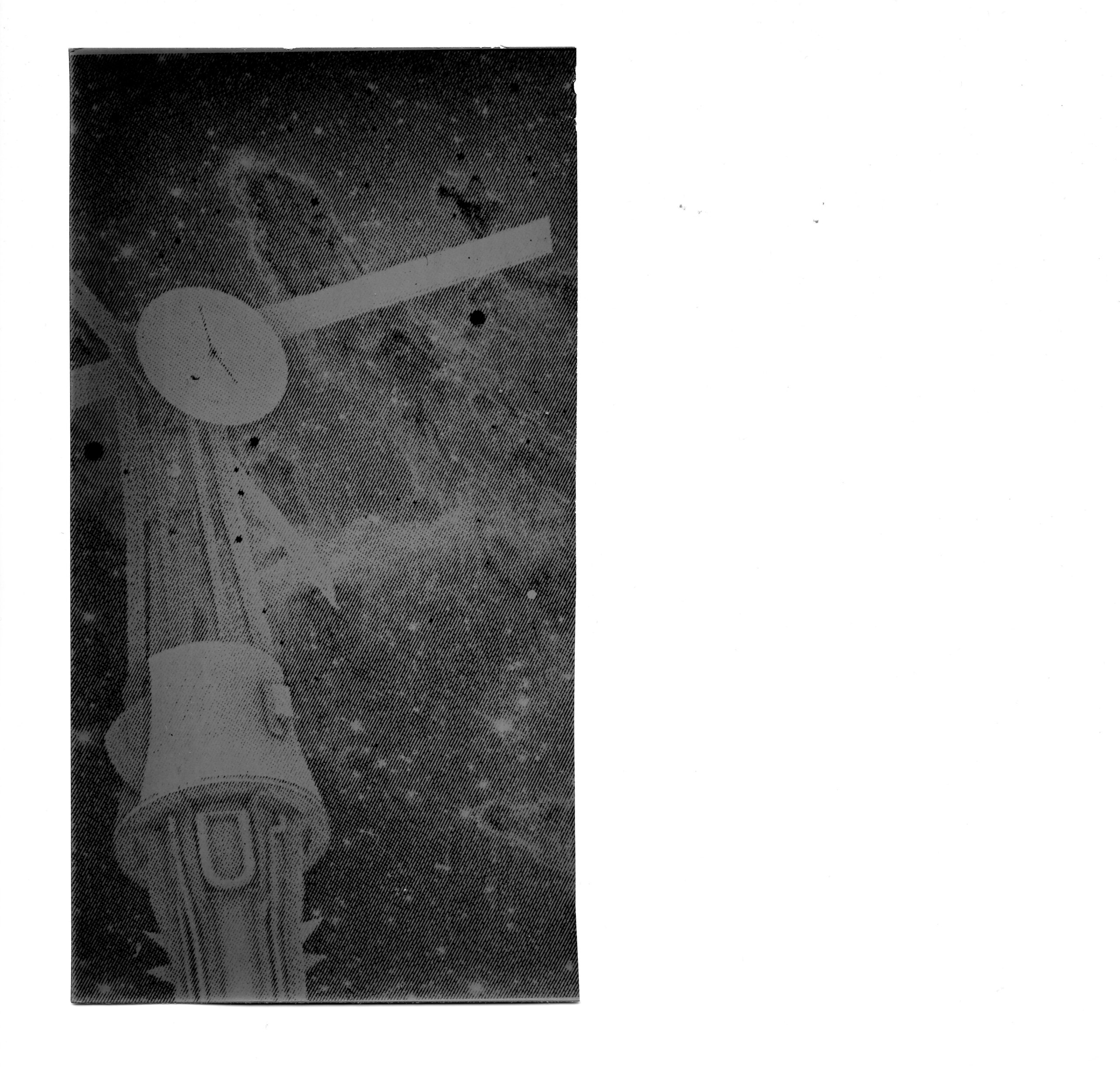
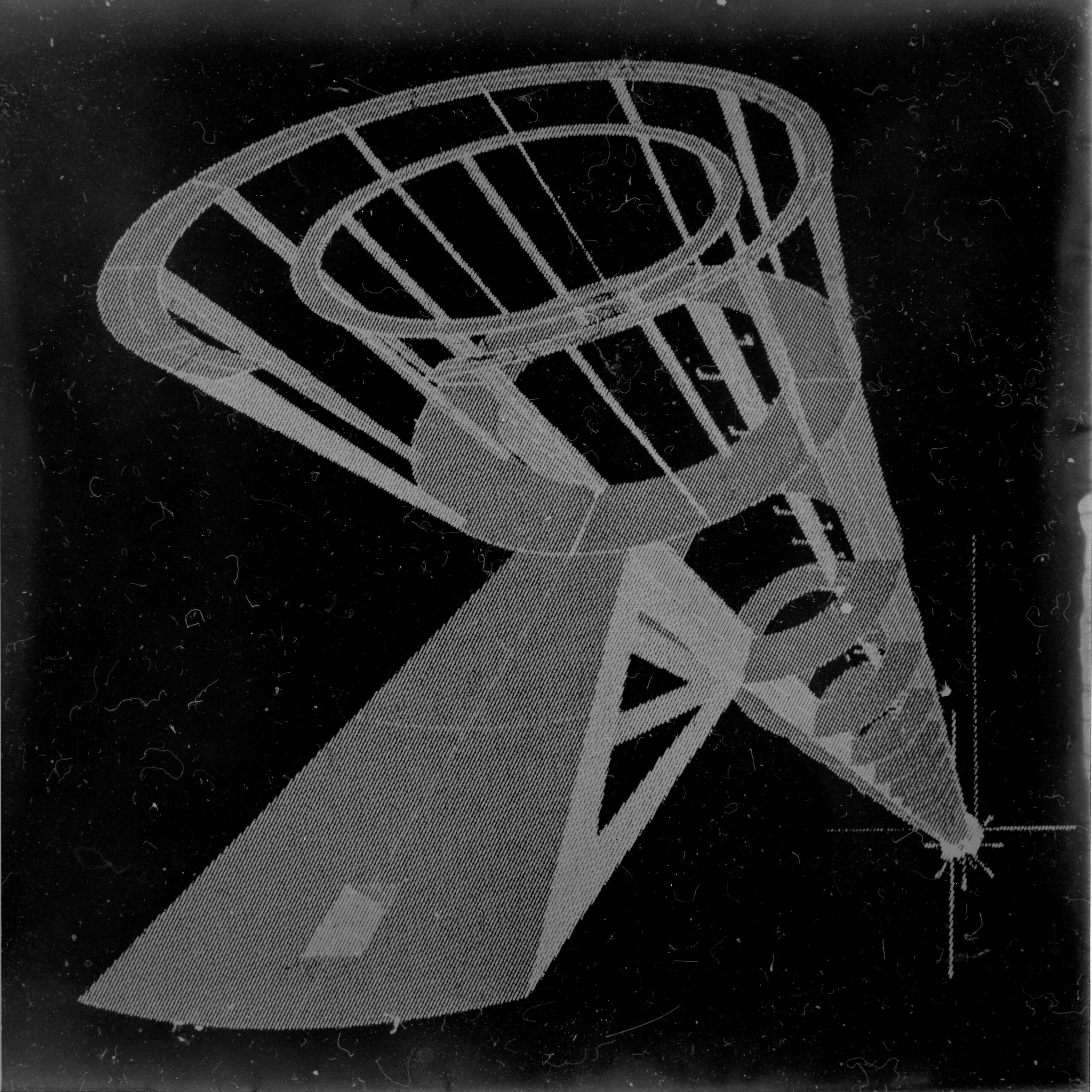
The surface at 7˚N, 78˚W in 1883 is an opportunist. This 42:1 darkroom enlargement of two steel plates meeting each other shows the miniscule crack through which light, and water, is able to pass.
At 5˚N and 82˚W, in 1976, the surface is indifferent. The resident ascends a 30-meter ladder, using the top-most platform as a podium to speak to the water’s surface and wait for its response.
Tell it your sorrows, read out the news, confess your love and admit hatred… Preach, or pry; it doesn’t matter.
Our endless pursuit of precision in measures both geographical and temporal has destroyed the ability to get lost, to be curious of what is beyond the horizon, to see monsters and live to tell the tale. Modern society is not without its own mythos however: By making real the coordinate grid, the project generates modern monsters and a sense of wonder for the drunken variousness, incorrigible plurality, and sudden beauty of the world that cannot be measured.