ANCON HILL
Ancon Hill is a Miocene igneous formation of dacite rock rising approximately 200m above Panama City’s historical centre, simultaneously overlooking Balboa and the Pacific approach to the Panama Canal. Unsurprisingly, these features made it a strategic location which have remained important over the years.
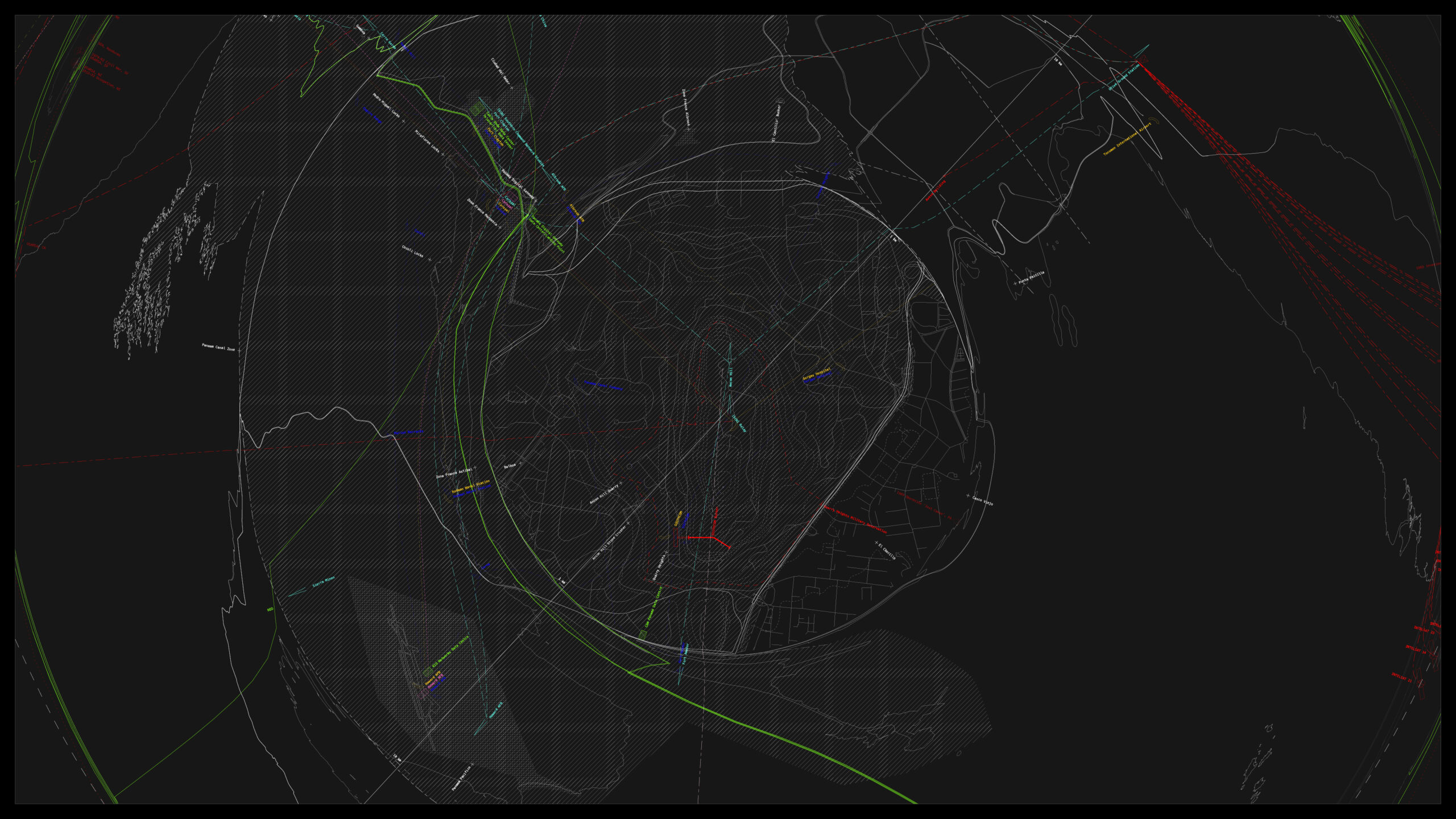
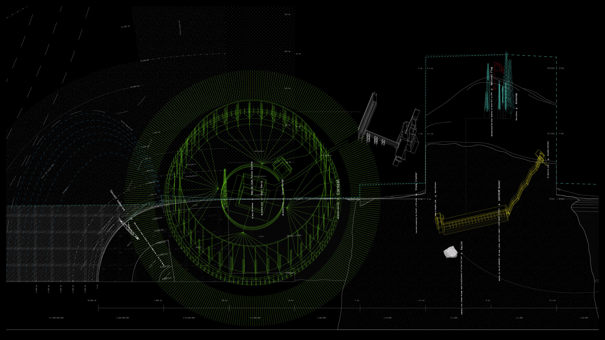
With the establishment of the Panama Canal Zone, the demarcation line between the extra-territorial entity and the Republic of Panama was drawn at the hill’s eastern slope, strategically incorporating it within the Zone. From that point on, the hill effectively functioned as both a natural buffer as well as an observation and control point between Panama City and the Zone’s newly constructed capital Balboa. After the western slope has been dramatically altered in mining operations for the construction of the Canal, it has been repurposed to house the Canal Zone’s most important administrative and military infrastructure: the PCZ administration building, the PCZ Governor’s residence, the various auxiliary institutions as well as Quarry Heights – a small neighbourhood that became the headquarters of the US Southern Command, an important command subdivision of the US Armed Forces, responsible for military surveillance, planning and operations in all of Latin America. This geological formation thus became a vital and indispensable node in the projection of US military ambitions onto a continental scale, crystallising in ’The Tunnel’ – a bunker installation constructed in the depths of the hill to house and protect SOUTHCOM personnel and communications from possible attacks.
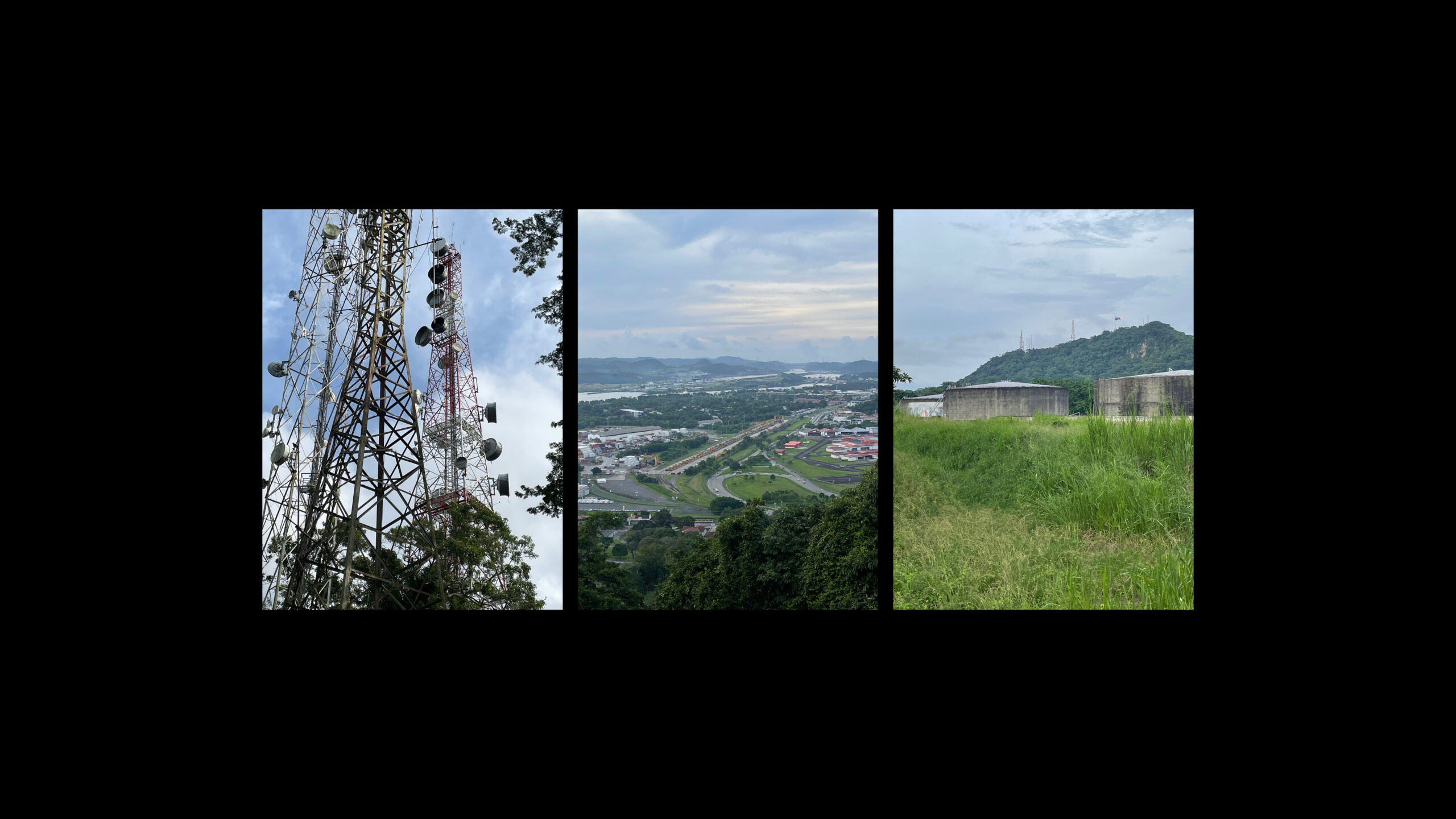
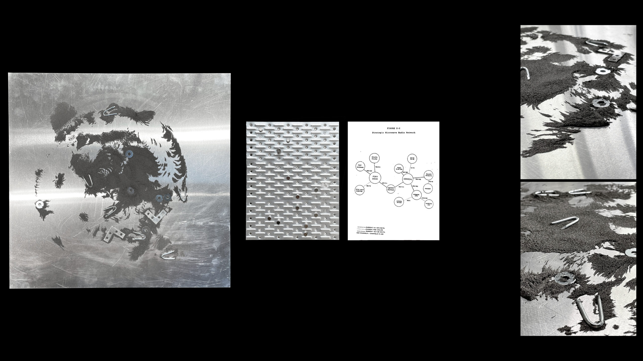
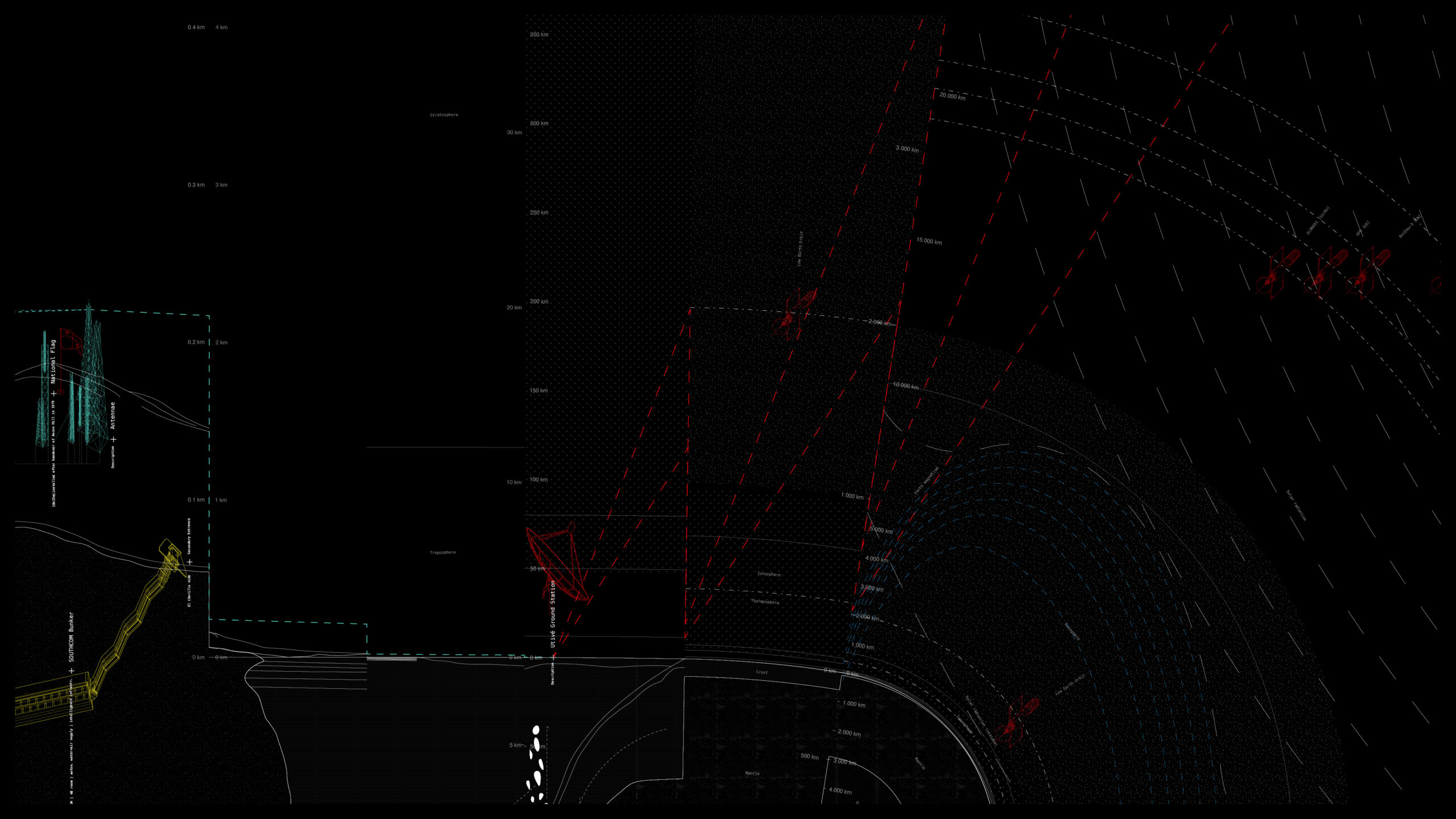
Most prominently, Ancon Hill’s dense forest canopy is pierced through an extensive array of communication antennas distributed through on its ridge. While currently mostly used for commercial telecommunications and broadcast, tracing those systems closely reveals an intricate and extensive network that structures and connects all important former military installations in the Zone, as well as tying into extra-zonial, extra-continental and extra-terrestrial communication systems once established for military use. Remarkably, one sees a stark continuity between former military communication paths and contemporary commercial ones which graft one-selves onto the pre-existing paths in a way that makes the two intricately entwined. Ultimately this mapping reveals a constellation whereby three locations operate as crucial strategic nodes in close relation to each other: the antenna array and underground bunker in Ancon Hill, the former communication hub and current submarine Cable Landing Point in Corozal on the eastern coast of the Panama Canal approach and a satellite ground station in Utivé, some 33 kilometres east of the hill.
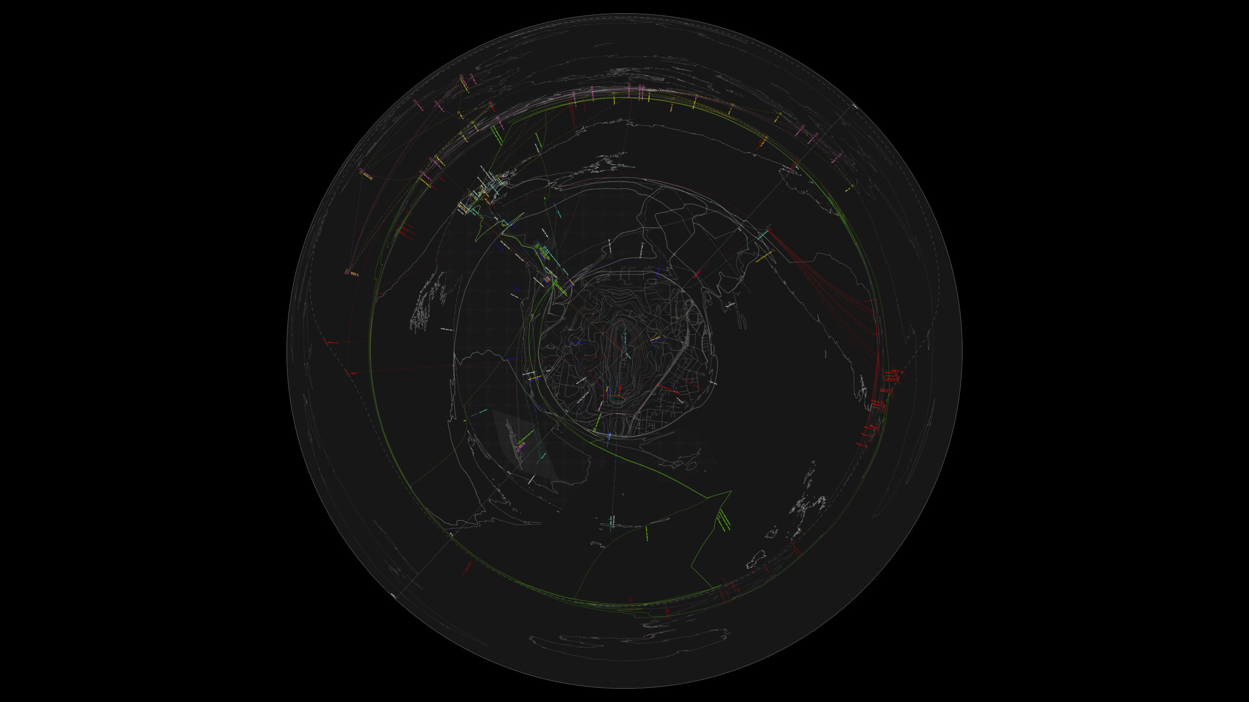


The unique character of this condition is defined by the trans-scalarity of its operational expanse. Going from very tangible materialities of the infrastructures in their immediate surroundings, these systems are shaped by and operate with territorial and planetary conditions such as geological processes of plate tectonics in the formation of the hill, atmospheric properties for the reflection of signals, bathymetry for submarine cables, or orbit distance and velocity for the positioning of communication satellites. This brings forward the necessity to develop an understanding of a ‘context’ as something beyond immediate spatial surroundings of a thing and rather to examine its operational-material expanse and the productive forces engaged in it.
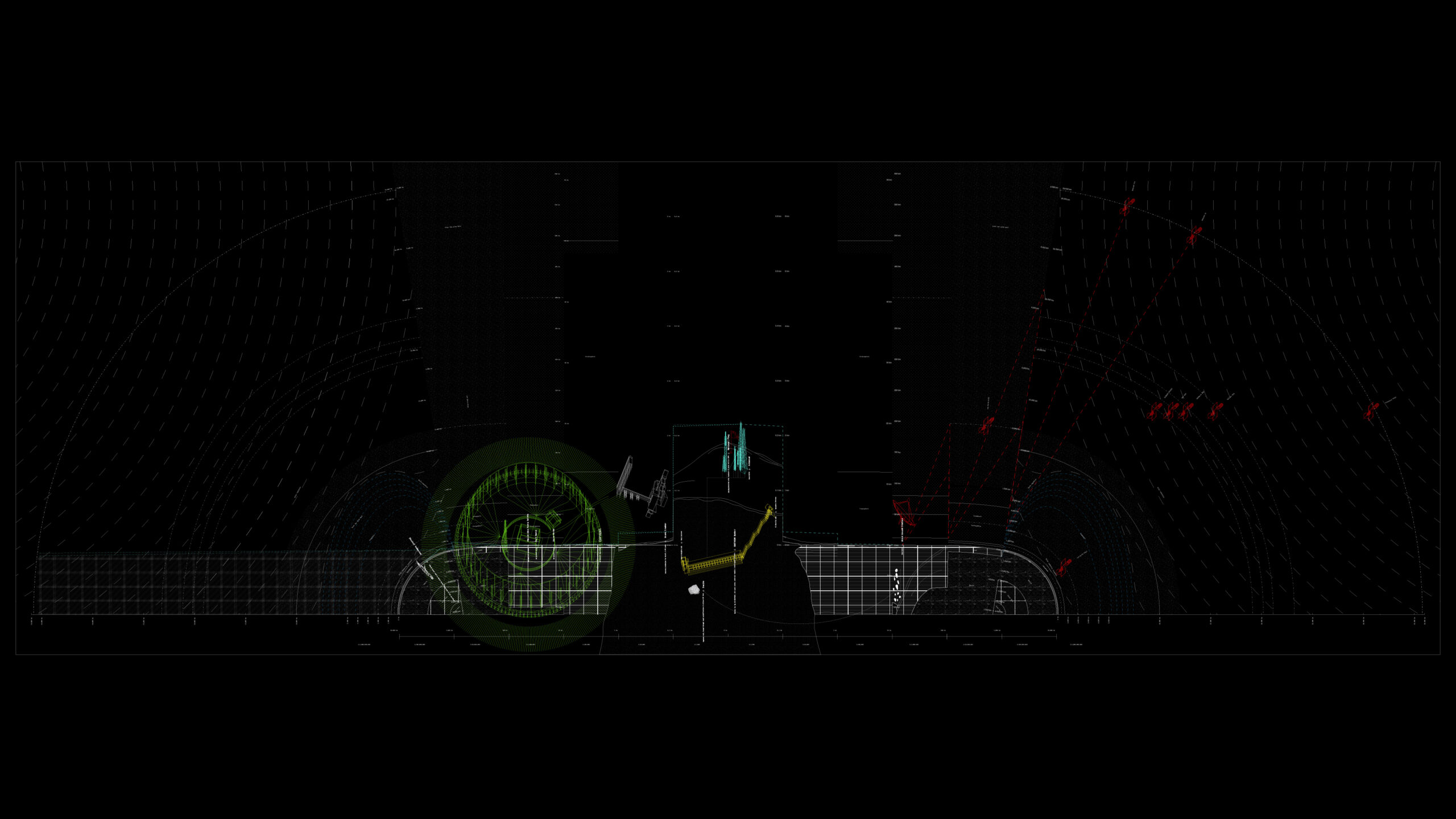
Starting to assemble and juxtapose the found zonefacts, this investigation renders visible how those start to draw intricate connections among themselves, structuring and organising the territory in the process as well as tying it into larger flows that go beyond both its spatial and temporal confines.