SITES OF PLAUSIBLE INDETERMINACY
Indeterminacy asserts itself as a complex spatial phenomenon, defined by both its physical manifestations and transient expressions. It operates across disciplines, influencing urban and rural processes and shaping social, economic and political landscapes. Given the failures of anthropogenic environments, it becomes necessary to examine territorial conditions through a lens that reveals spatial and ecological complexities. In this project, Indeterminacy is both a subject of study and an analytical tool, enabling a deeper understanding of territorial transformations. As a result, the interplay between theory and praxis becomes essential in dissecting landscape conditions, allowing for a new understanding of territory — one that embraces simultaneity and flux.
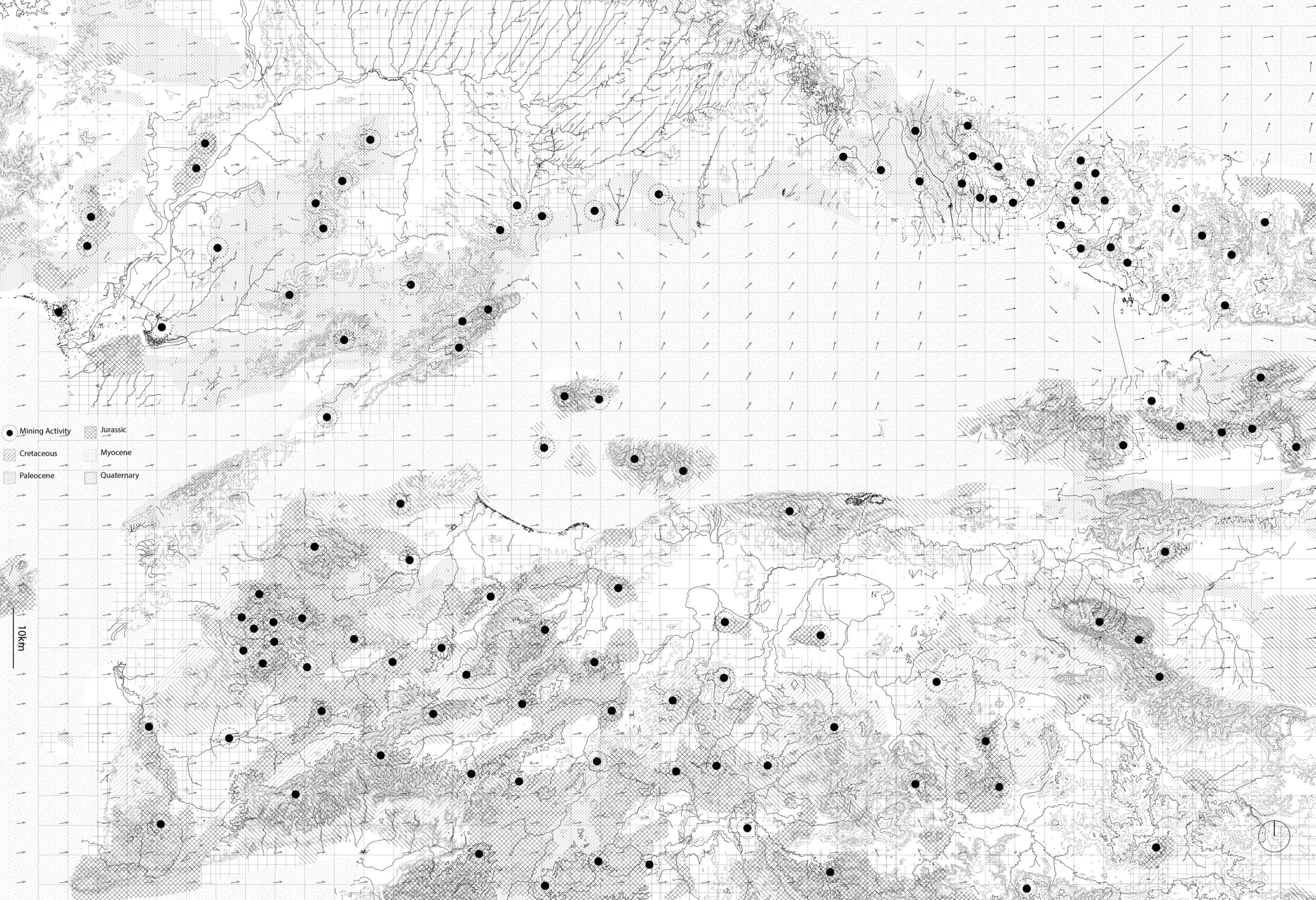
The research begins by framing the study area as a temporal condition where Indeterminacy emerges. The five-year industrialization plan implemented by the Turkish government led to a rapid expansion of mining activities, introducing a new wave of landscape alterations. These industrial interventions generate intense ecological and social transformations, reshaping the land in ways that resist fixed categorization.
The Çanakkale region is the focus of this investigation due to its high concentration of landscape alterations, which create zones of heightened Indeterminacy. Figure 1 illustrates the distribution of mining sites across the Marmara Basin, overlaid with geological epochs that shaped the current landscape. The abrupt nature of these land alterations, when juxtaposed with the long temporal scales of geological formations, highlights the disruptive impact of extractive industries. The territorial scars left behind serve as material evidence of this accelerated transformation.
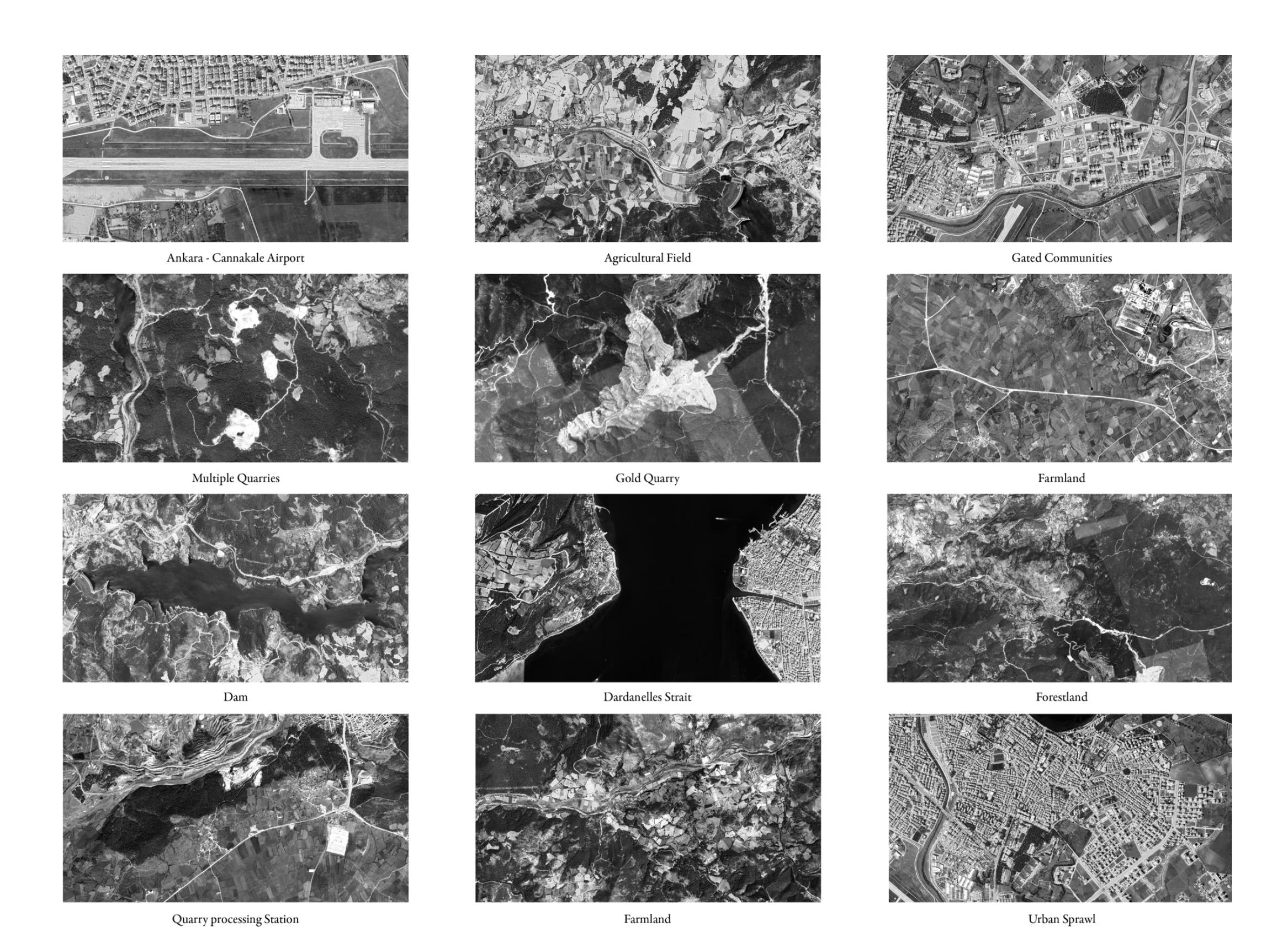
A closer examination of the Çanakkale region reveals a direct correlation between landscape alterations and infrastructure development. The highway linking Çanakkale to Balıkesir emerges as a critical spatial element, acting as both a conduit for economic expansion and a marker of territorial change. Figure 2 highlights the dense clustering of landscape alterations along this infrastructure, positioning it as a spine of plausible indeterminacies.
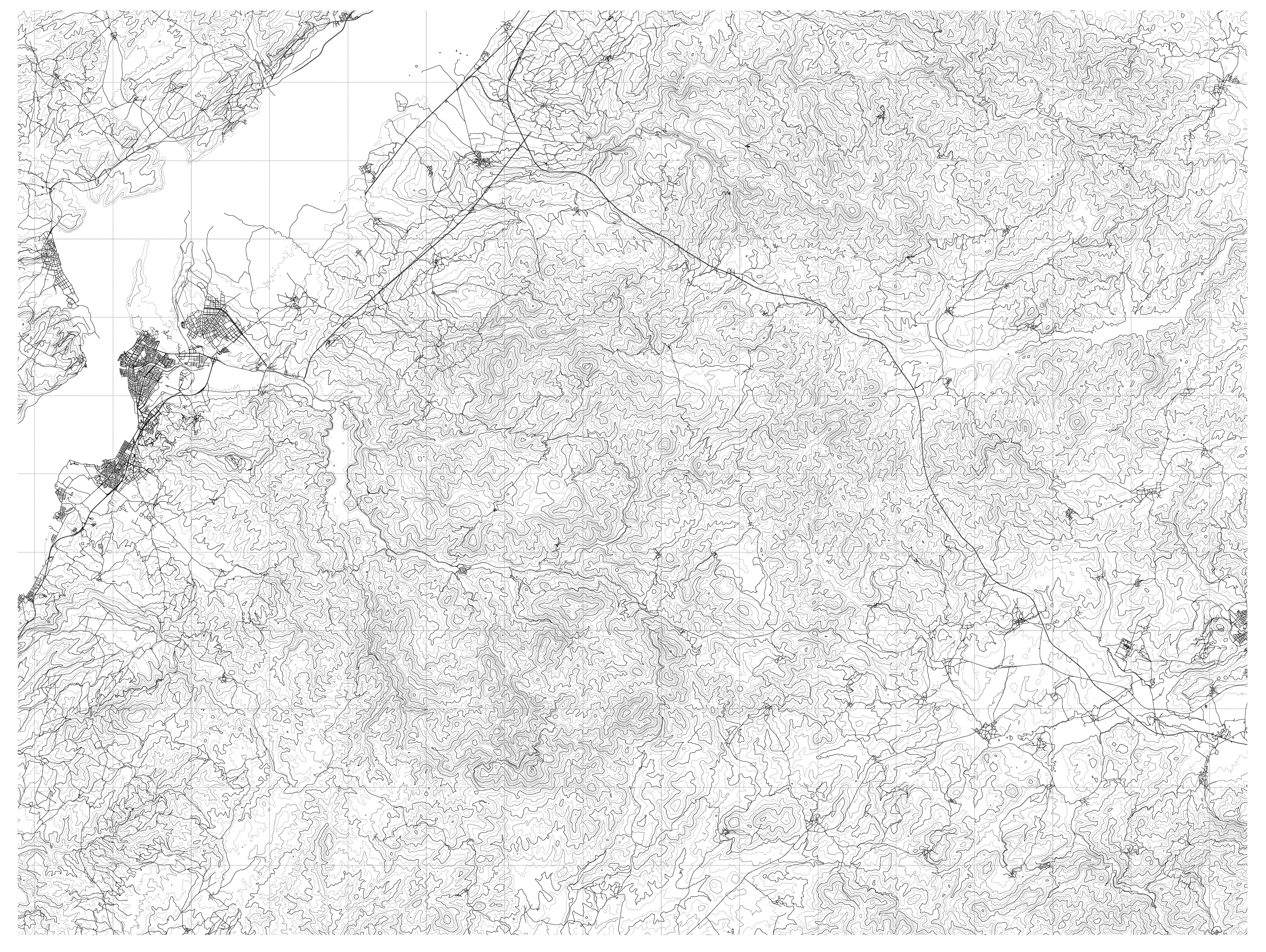
A topographic survey of the region further unpacks the interactions between built and natural environments. This analysis identifies landscape scars not as isolated disruptions, but as active agents shaping topographical and infrastructural systems. Each landscape iteration is contextualized, making visible how indeterminate forces actively reshape the terrain. This survey maps out the actors of this altered landscape, revealing how infrastructure functions as an organizing element within an evolving spatial order.
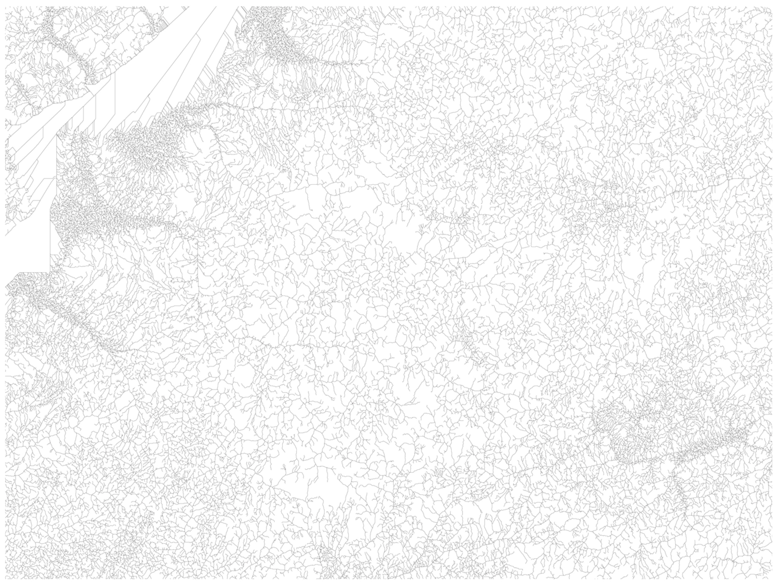
The investigation extends to the phenomenon of acid lake formation, prompting a reevaluation of landscape anomalies and their systemic consequences. By stripping the map down to a single geological identifier – the underground catchment and water erosion channels – an interconnected hydrological network is revealed. These water systems act as vectors for the transmission of industrial byproducts, carrying toxic particles released by mining activities. Overlaying land cover data reveals a direct correlation between rangeland and areas downstream of mining sites, confirming that pollutants migrate through a porous landscape. Each land alteration functions as a ‘plugin’ within the larger network, contributing to the formation of an oligoptic landscape, where multiple fragmented yet interdependent elements shape an evolving spatial reality. The Çan open-air coal mine, positioned along the highway corridor, emerges as the primary intervention site. Its strategic location within this network of territorial transformations makes it a critical node in the study of Indeterminacy.
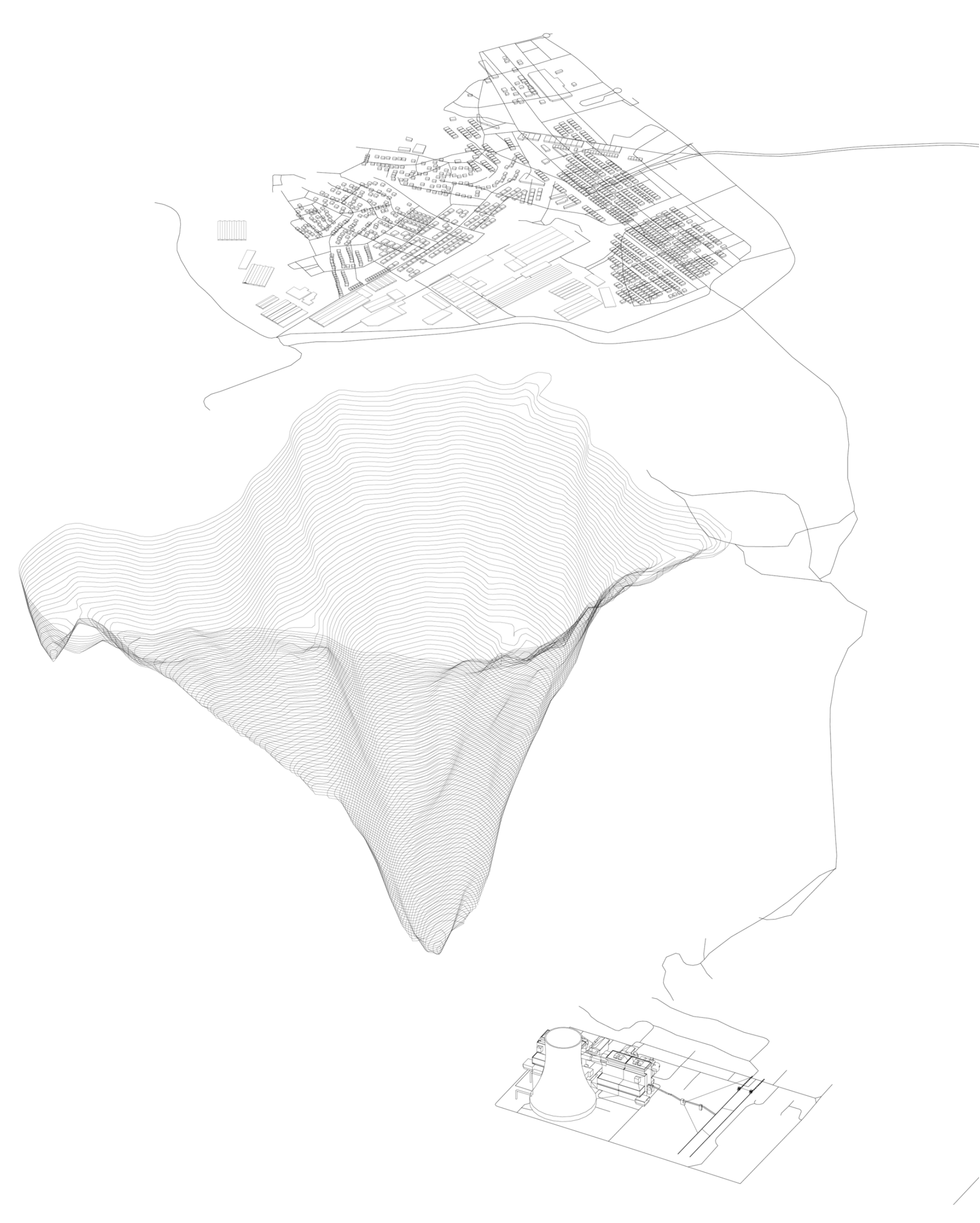
The coal town of Çan represents the terminal node of the investigated highway, enclosing a closed industrial ecosystem composed of a town, a coal mine and a power plant. However, a closer look at the area surrounding the Çan coal mine reveals a series of acid lakes — water bodies hostile to life due to their low pH and high concentrations of acidic minerals and heavy metals.
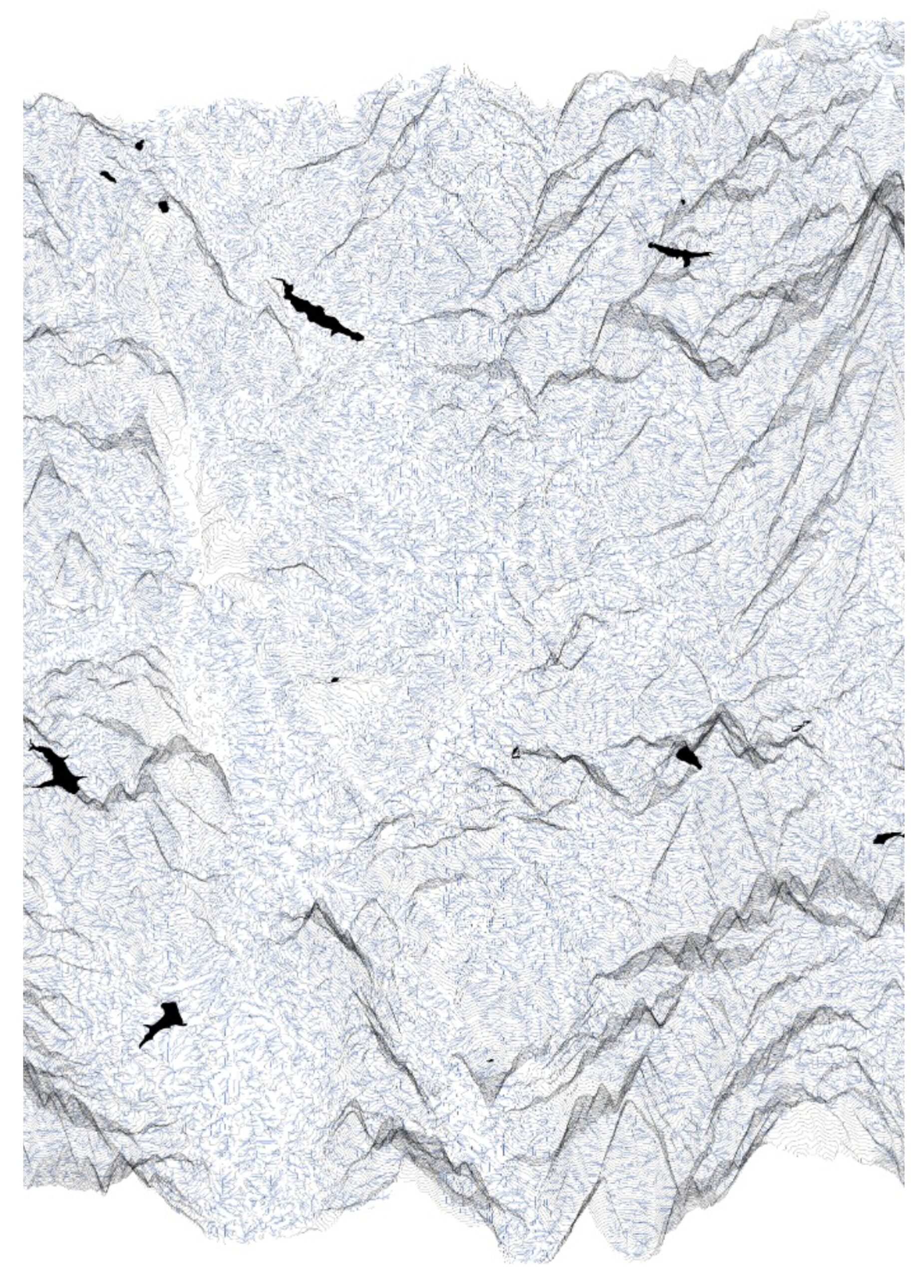
The appearance of these lakes is a direct consequence of industrial runoff, where heavy metal particles and acidic compounds accumulate in depressions, forming toxic reservoirs. These lakes act as material archives of industrial toxicity, capturing the ephemerality of landscape transformation. The Çan mine, which produces 2.5 million tons of coal annually, is first perceived as a gaping wound in the terrain. However, closer analysis reveals its entanglement with overlapping ecological systems, amplifying its far-reaching impact on territorial conditions.
The Çan mining site is not merely an industrial scar, it is a catalyst, generating shockwaves of spatial and ecological transformations. It functions as a ‘tumor’ within the landscape, spreading toxicity through its deep entanglement with hydrological and atmospheric networks. This interconnectedness underscores the need to reconceptualize landscapes as dynamic, interwoven systems, where Indeterminacy is not an exception but an inherent condition of territorial processes. By reframing the landscape as a site of plausible Indeterminacy, this study positions Indeterminacy not as a failure of design, but as an opportunity for critical spatial inquiry. Understanding how these forces shape environments in unpredictable ways allows for new methodologies in territorial analysis — ones that acknowledge flux, adaptation and the complexities of Anthropogenic transformation.