EXTENSIBILITY AND INTENSITY
Operating in the dark brings with it an inherent possibility of the unknown – the possibility to make mistake, or in the case of open-water travel, run aground in shallow reefs or otherwise drift off without even knowing it. The lighthouses of Panama serve to indicate particular locations with particular light signatures – timed intervals of blinking light that distinguish one lighthouse from another – and this system of lights continues throughout the extent of the Panama canal, ensuring boats remain in the deepest parts of the channel.
On the Pacific coast there are seven lighthouses that share a specific light signature with another. This allows for a ship captain to confuse one location with another, to make a mistake. In that moment of confusion, when two lighthouses exist in the same location, the mental model of Panama becomes something completely different; a different shape.
It’s also important to note that the same rigid system of measure is applied to the surface of the ocean along the vertical axis.

Depth measures for centuries have been done in something called Fathoms – and Figure 10 shows a print from 1555, an anthropological study by Olaus Magnus of the Nordic people at the time. We can see two characters retrieving a plumb line from the depths to measure how many fathoms deep the water is; one fathom was the distance of outstretched arms. So it comes to be that waters too deep for the line, unable to be embraced by outstretched arms, were ‘unfathomable’.
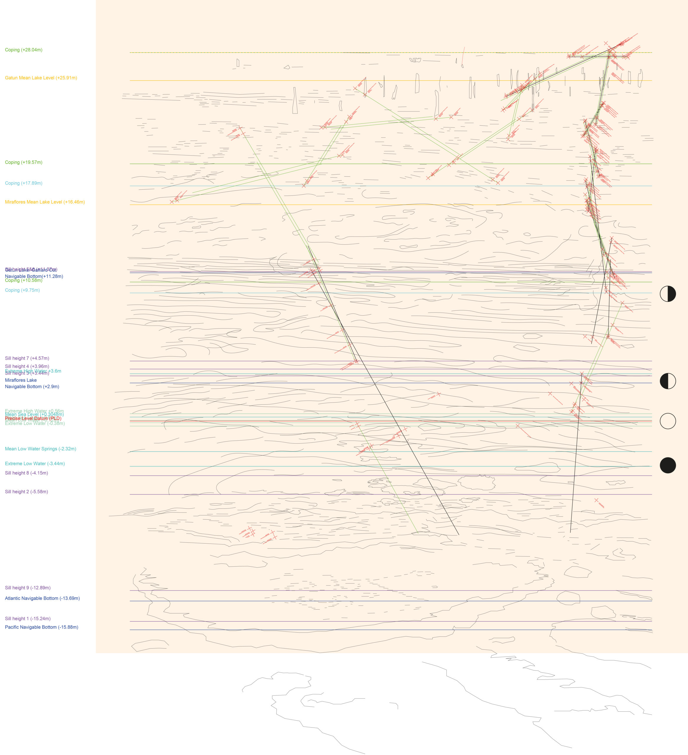
Out of these analyzes emerges a relationship between light, position, and topology of the continent which can (dis)place a boat in the captain’s understanding, even if just for a moment. The idea of the datum, or the fixed abstract line in top down or sectional understanding of space is in fact non-existent, however, these datums have become the tools with which we make sense of the world. Further yet, these abstract lines have concretized to such an extent that we are in fact reliant on them in order to function; the abstract measure has replaced the tacit knowledge of depth, orientation, and position. This is a spatial and temporal griding. The project seeks to explore the paradox that is the collision of the hyperlocal experience of site, with the extensible and systemic measure that positions it somewhere .
The project takes shape by looking at this issue not as a singular one, but as something inherently multiple. In other words, it aims to reveal the absurdity of the reductive and systemic measure by subverting the Cartesian logic of the sectional datum lines and the grid of the map.